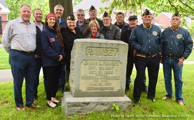
Loveland, Ohio – This is a story we first published in May of 2019. Cassie Mattia interviewed Steve Max, representing the Loveland Legace Foundation, and Rob Geiger the President of the Ramsey Paxton Cemetery Association as they were kicking off a new fundraising campaign for the cemetery’s restoration.
Rob told Cassie some of the history of the burial site and its historic significance to Loveland, Clermont, County, and the State of Ohio.
Loveland, Ohio – The Loveland Legacy Foundation has partnered with the Ramsey-Paxton Cemetery Association, Inc. and will offer a dollar-for-dollar match up to $1,500 to complete the funding needed to restore the historical cemetery located in White Pillars subdivision on Ramsey Court. With your help, and this matching grant, the restoration work will be completed this summer and this historically significant site can be restored to a level of care that it deserves.
In this LOVELAND MAGAZINE TV video Cassie Mattia talks with Steve Max and Rob Geiger about the history of the cemetery, who is buried there, and the announcement of the matching grant.
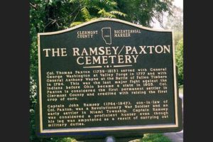
The first burial at the cemetery was Lt. Col. Thomas Paxton in 1813, a Revolutionary War patriot who dined with General George Washington as one of the officers of the day at Valley Forge on Christmas Day in 1777. Paxton also was chosen by General Anthony Wayne to lead the advance guard at the Battle of Fallen Timbers in 1794.
Paxton was credited as being the first permanent settler in Clermont County. Paxton and his sons-in-law carved out the wilderness to make a home for their families in 1795 and brought their wives and children here to Loveland in 1796. Paxton is the founder of Clermont County, Miami Township, the city of Loveland, and he helped with the Statehood of Ohio.
Capt. John Ramsey, Paxtons’s son-in-law, also a Revolutionary War patriot, is buried in the cemetery along with other family members.
The Loveland Legacy Foundation, passionate about preserving our founding families’ place of rest, has partnered with the Ramsey-Paxton Cemetery Association to restore the historic Loveland landmark. Other partners include American Legion Post # 256, American Legion Auxiliary Post #256, Bond Home Furnishings, City of Loveland, Clough Valley Daughters of the Revolution, Eads Fence Company, Loveland Magazine, Paxton’s Grill, Ramsey’s Trailside, Loveland Sweets, and Rainey Tree Service. They have all united together to make this project a reality which will include the removal of the dead and decaying trees, the replacement of the chain link fence with a 4’ black aluminum industrial grade fence, and a 10’ antique wrought iron gate provided by Eads Fence that will be fully restored and installed.
You now have an opportunity to help secure the final part of the funds needed with this generous match from the Loveland Legacy Foundation which doubles the value of your donations up to $3,000.
Visit these local downtown Loveland businesses to place your donation in the donation jars at: Bond Home Furnishings • Eads Fence Company • Paxton’s Grill • Ramsey’s Trailside • Loveland Sweets.
Make out a check, payable to Ramsey-Paxton Cemetery Association and mail it to Rob Geiger, PO Box 25 Loveland OH 45140.Both Loveland Legacy Foundation and Ramsey-Paxton Cemetery Associations are 501-3C organizations so your contributions may be tax-deductible to the extent allowable by law.
The Ramsey-Paxton Cemetery is a hidden gem locally, statewide, and nationally. Jan Beller, Director of the Loveland Museum Center (Greater Loveland Historical Society) said: “We are fortunate to have such a historical site right in our own thriving town!”
Steve Max, Chairman of the Loveland Legacy Foundation, and Rob Geiger, President of the Ramsey-Paxton Cemetery Association both added: Thank you for joining us to see this project through and living up to our motto “Loveland Strong.”
Read about the recent celebration on May 17, 2022:
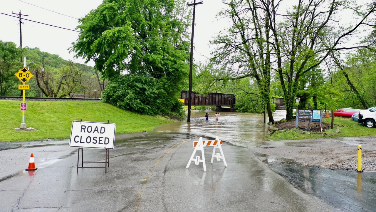
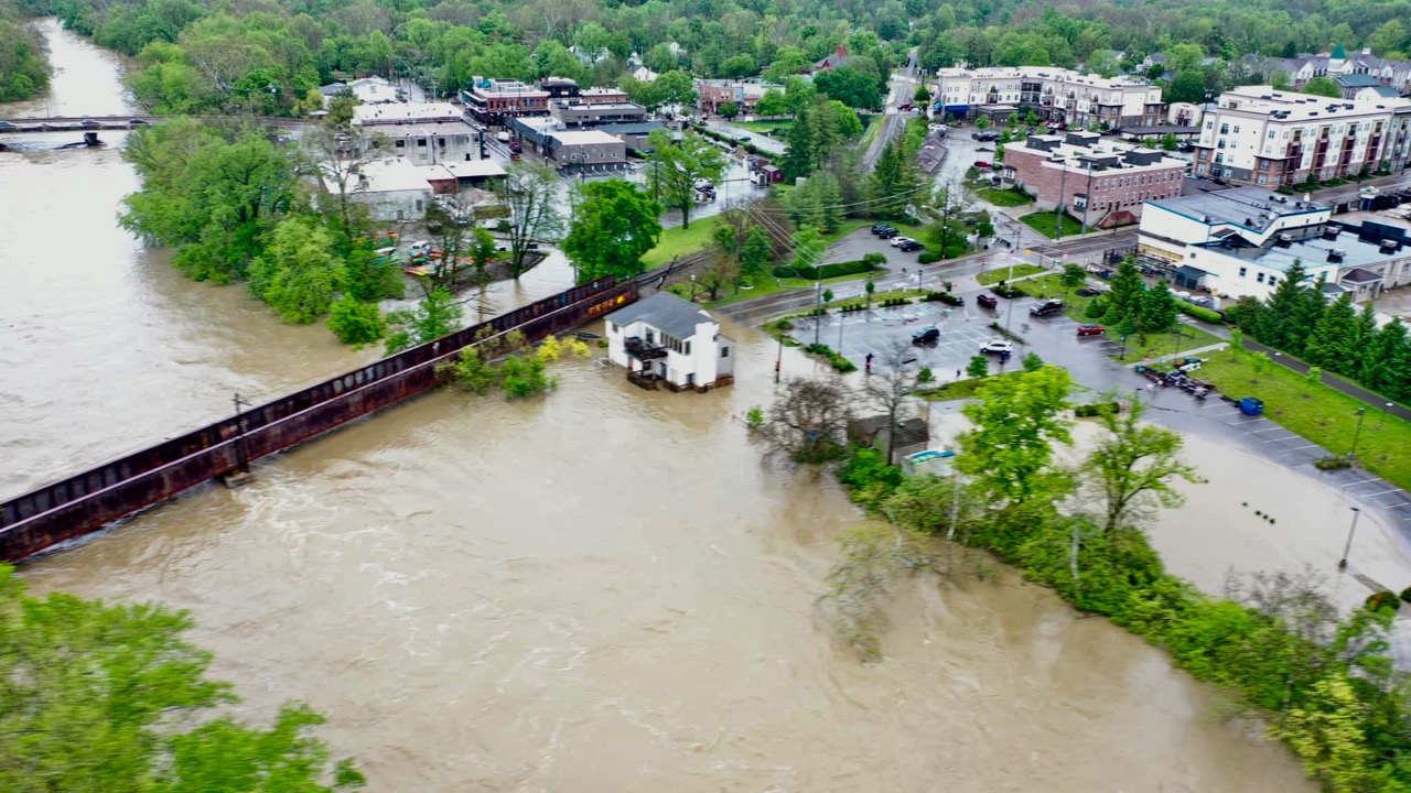
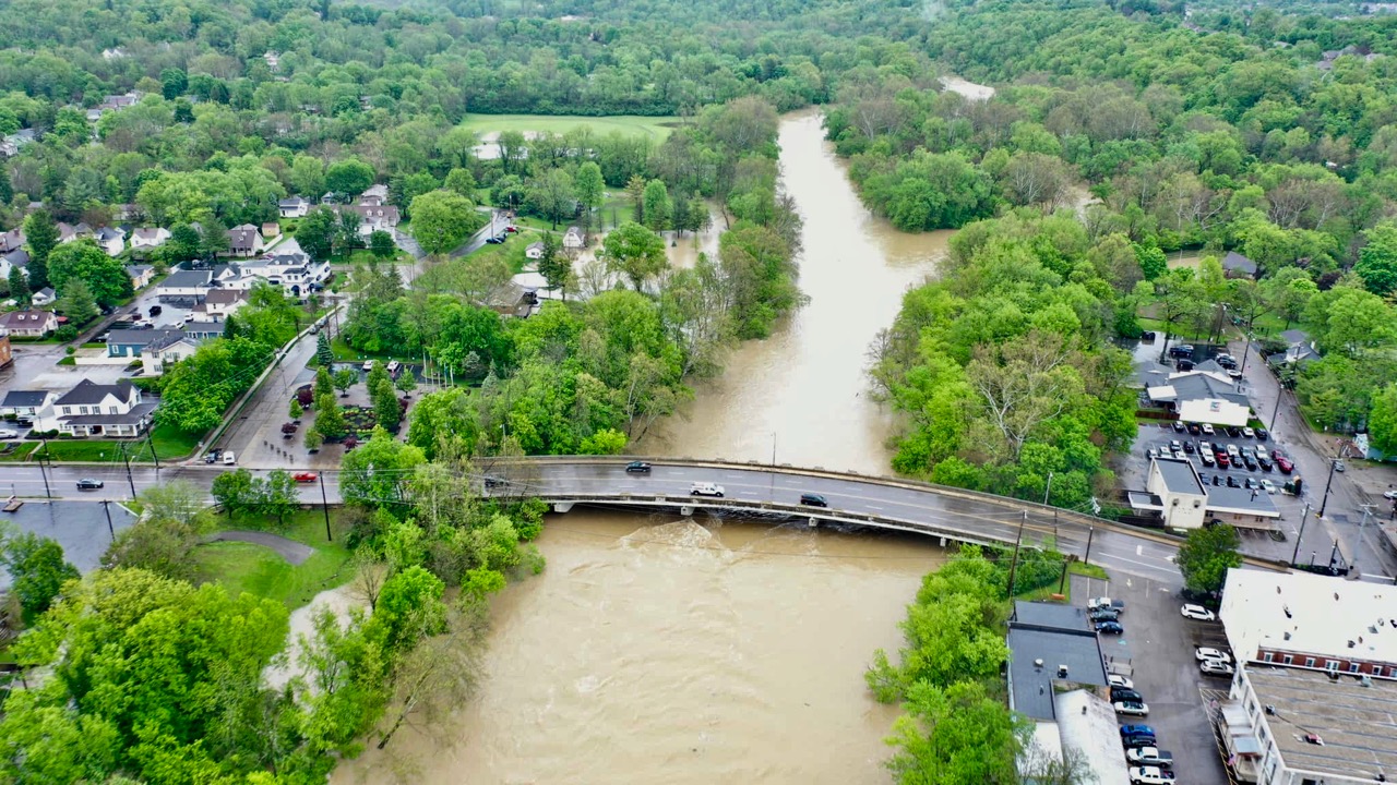
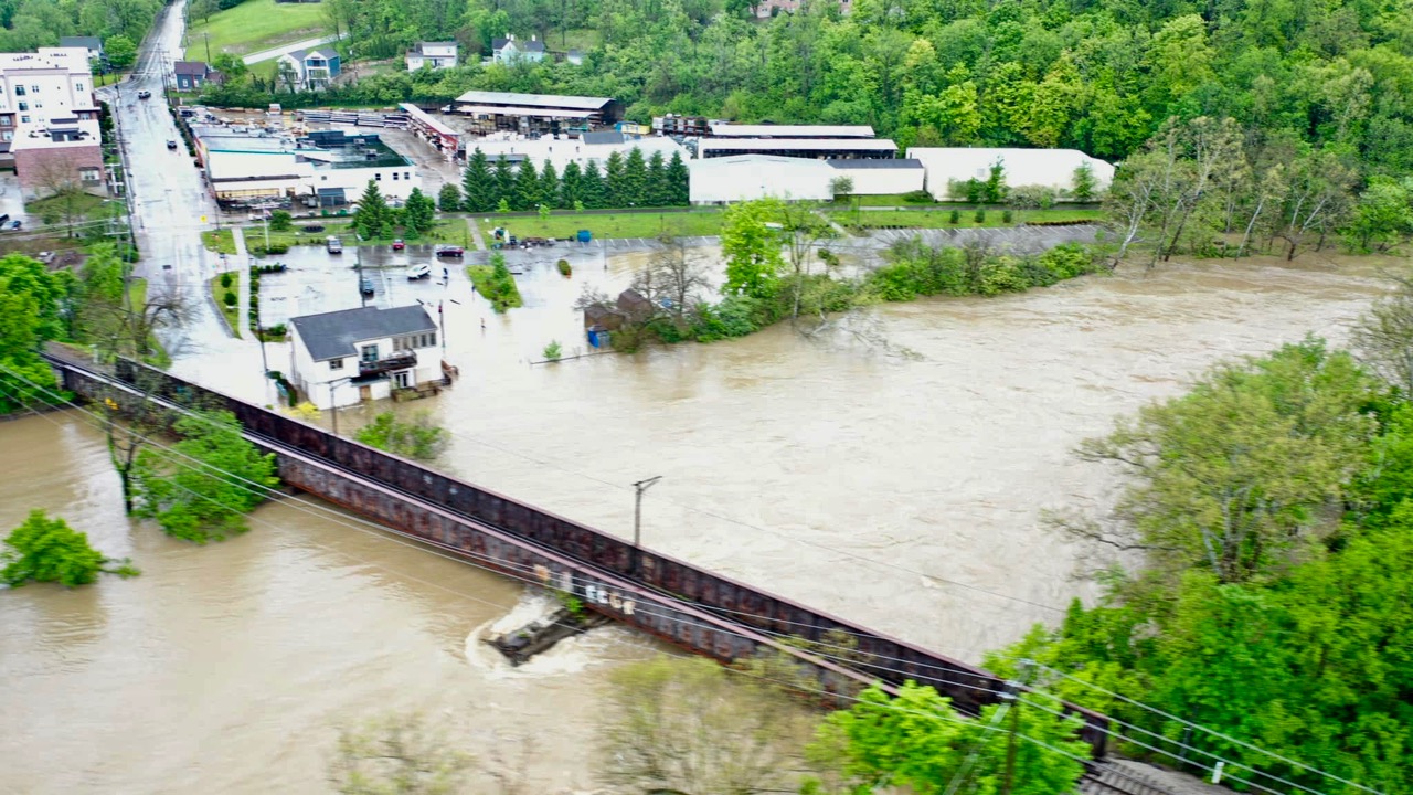
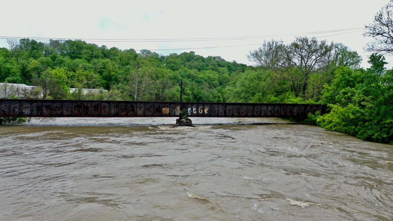
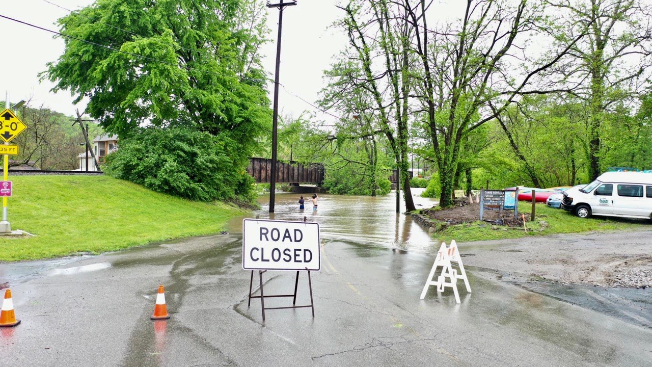
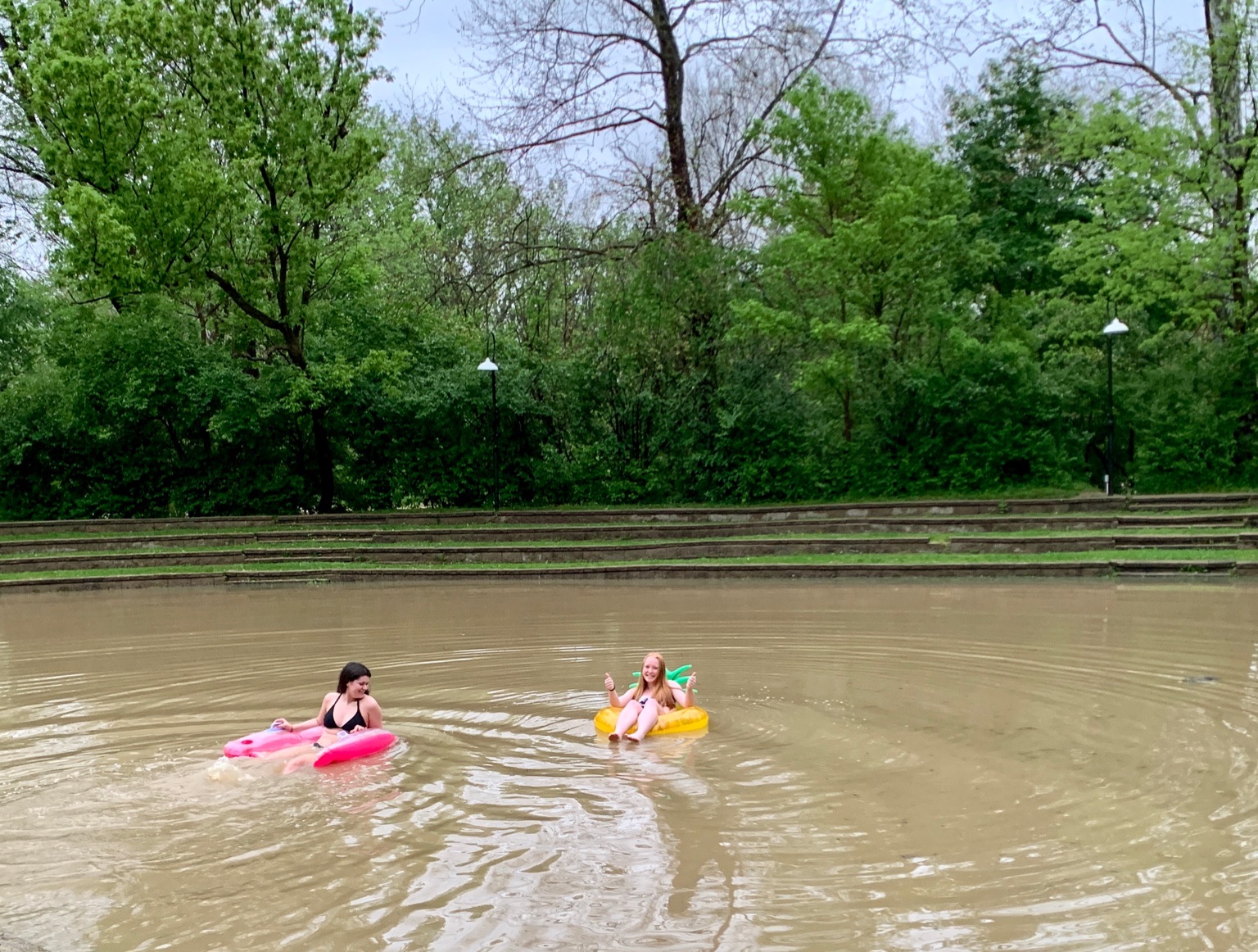
Loveland, Ohio – Just when local folks thought things were returning to the way they were, Barbara Streisand style, mother nature had another trick up her frock to show us who’s boss when around 4″ of rain swelled Loveland’s streams Tuesday morning. For those with a flooded basement or business, swell would be a wrong description.
Memories light the corners of my mind Misty water-colored memories of the way we were Scattered pictures of the smiles we left behind Smiles we gave to one another for the way we were
Can it be that it was all so simple then Or has time rewritten every line
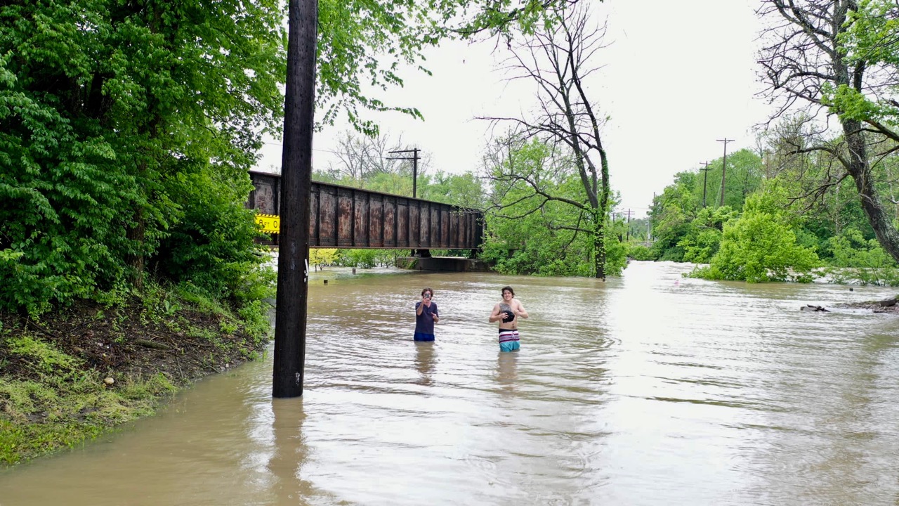
Here are some of the videos and photos sent our way. We appreciate these in the way it documents Loveland, Ohio on May 19, 2020.
A return to normal is a typical Spring rain event when the town is divided by the State and National Scenic Little Miami River.
This video was sent by Cindy Wilmes.
This video was sent by reader Nick Dyson.
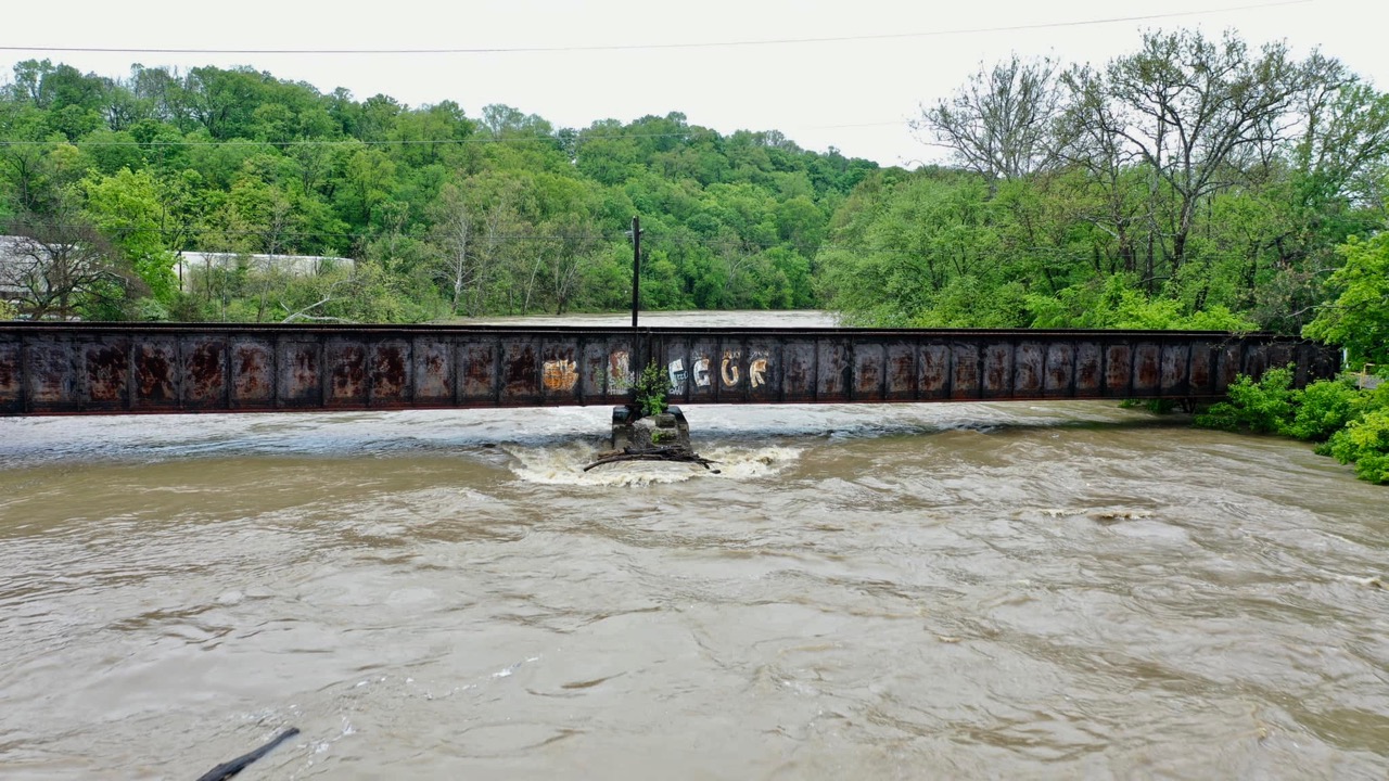
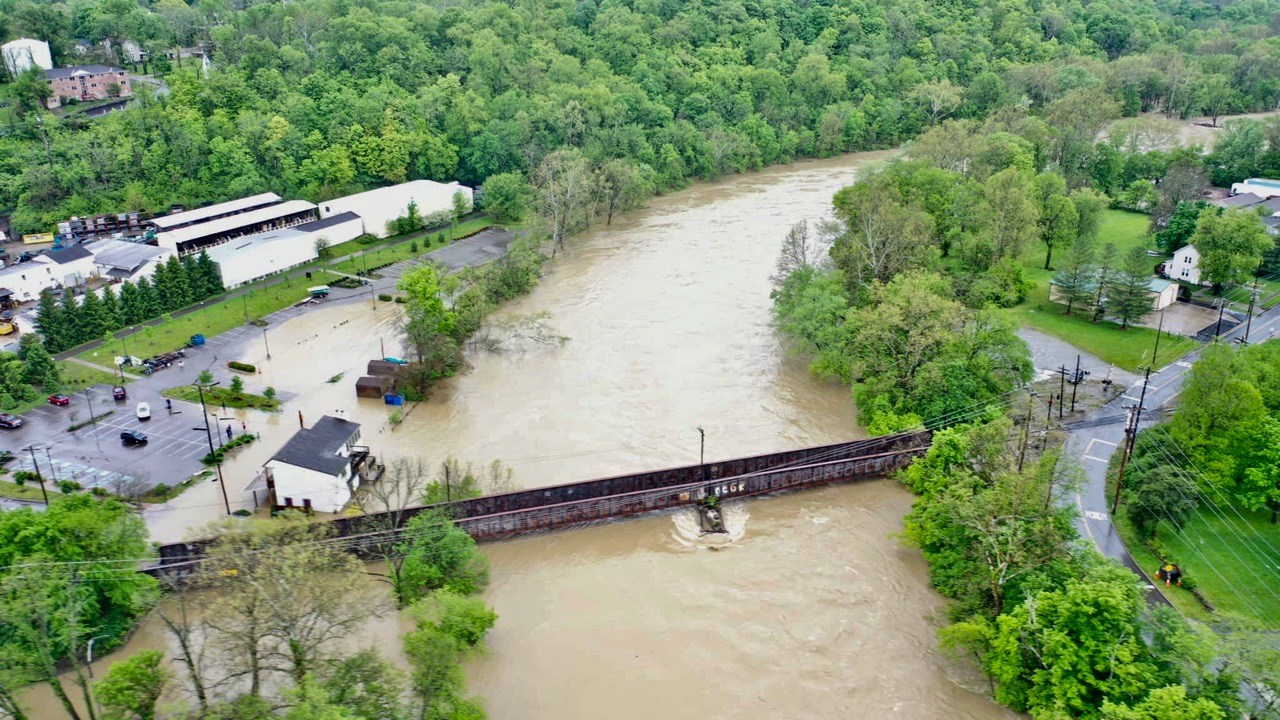
This aerial footage and the following photos were taken by Steve Beamer who puts all of Loveland in the passenger seat of his drone.
Wait till Steve takes you just a few feet from the railroad overpass where the water crashes into the pillar with such tremendous force.
Wait till Steve flys you under the Col. Paxton Bridge at West Loveland Avenue then soars high above Historic Downtown.
These photos were sent to us from Eileen Washburn.
EDITOR’S NOTE: In reaction to this editorial, City Council voted on Tuesday, April 24 to have a public hearing on this proposal during the City Council meeting of May 9.
It’s past time City Hall start a dialogue with those most affected
by David Miller, Publisher
Come take a walk with me while I tell you a story
It’s just my opinion, but I believe City Hall should start talking to people about this before it gets so far along people will need 1.6 million dollars worth of arguments against it. Once City Hall gets the funding for what they will describe as “Free Money” it will be extremely hard to turn council members to “No” votes. Residents should be given a fighting chance.
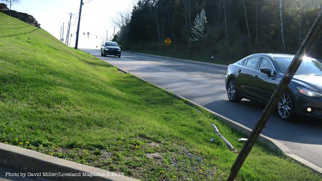
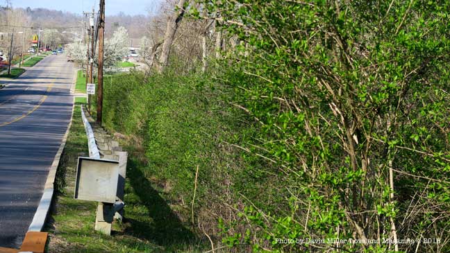
As the equivalent of a one-lane asphalt road that will cozy within feet of the front doors of homes and businesses in the West Loveland Historic District and along Loveland Madeira Road, and City Hall moves closer to securing funding, property, and homeowners have yet been asked their opinion. Almost all do not yet know the proposal has already been partially funded by Hamilton County and the Ohio, Kentucky, Indiana Council of Governments has committed their resources to finding 80 percent of the $1,623,000 and growing price tag for construction.
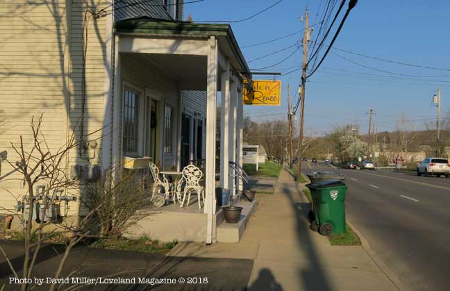
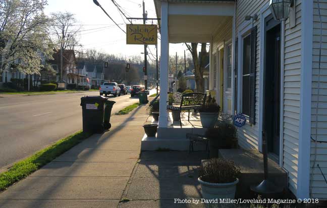
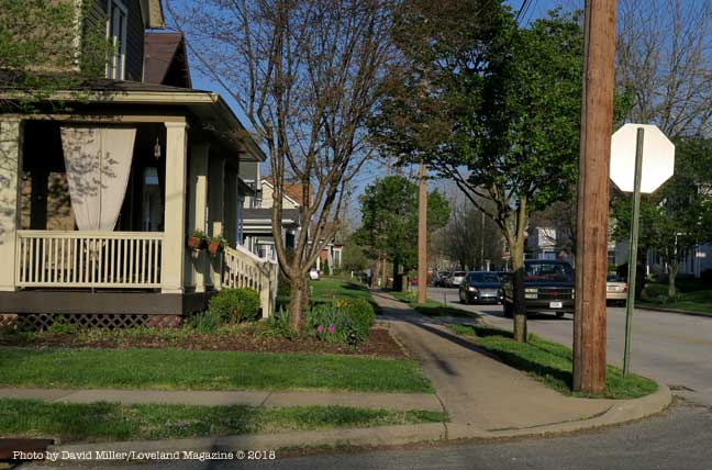
This is a view of the North side of West Loveland Avenue where construction of a 12′ wide swath of asphalt would require the removal of the front porch of this business. The entry to the basement of this business is through the porch floor.
Some front porches would have to be removed to accommodate the 12’ wide asphalt bicycle road. The road will be reduced to 10’ wide only where construction proves difficult.
As the City Hall proposal gets yet more expensive and closer to fruition there is still no initiative from the Council table to ask the thoughts and suggestions of citizens, home-owners, affected businesses, property owners, or pertinent City Commissions and Committees.
As the City Hall proposal gets yet more expensive and closer to fruition there is still no initiative from the Council table to ask the thoughts and suggestions of citizens, home-owners, affected businesses, property owners, or pertinent City Commissions and Committees.
One property and business owner along the proposed route wrote to City Hall. Paul Elliott said, “I am under the impression that such a proposal ‘has legs’, and city officials are even seeking funding sources. First, as a taxpaying resident and longtime business/property owner on West Loveland Avenue, I am disappointed that no city official has approached either the public in general nor us property owners who may be affected by such a bike corridor.”
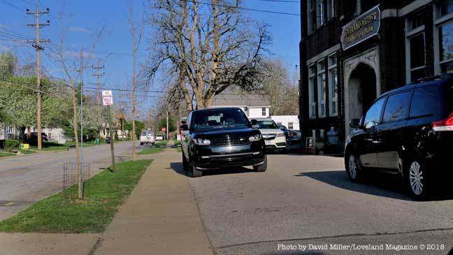
The project, called the Loveland Connector Trail, will be approximately 1.4 miles long and will begin at the Deer Ridge II Apartments being built next to New Hope Baptist Church. It will continue along Loveland Madeira Road to Main Street, to the southern part of Wall Street, then to West Loveland Avenue, crossing over the Little Miami River at the Col. Paxton Bridge ending in Historic Downtown.
“I am disappointed that no city official has approached either the public in general nor us property owners who may be affected by such a bike corridor.” – Resident and affected business owner, Paul Elliott.
The goal and impetus for the project are to reduce congested parking in the Downtown Historic District by encouraging Loveland Bike Trail users to park somewhere along the new bike road and ride their bikes into Historic Downtown.
City Manager, Dave Kennedy announced in February that he was confident he will find 80% of the $1,623,000 cost from the Federal Government. He has since announced changes that will raise the price tag an undetermined amount.
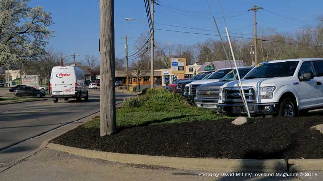
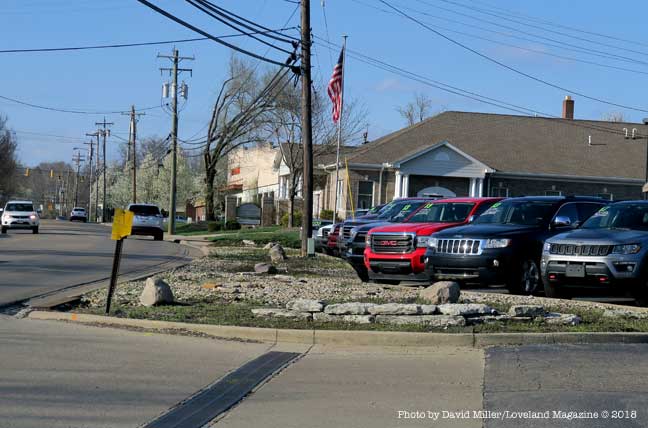
A view of an automobile dealership that has softened their business frontage. Something will have to give way for the proposed 12′ asphalt bike road.
The study does not contain any data on the potential number of users, nor potential customers to Loveland Madeira Road businesses. The study also does not address any repercussions on the residential neighborhood of Main Street or the Business/Residential neighborhood on West Loveland Avenue. For instance, it does not address future maintenance or whether property owners will be responsible for snow and ice removal on a path that replaces their current sidewalks. It’s right to ask when residents are left without sidewalks, “When will the bike road be cleared of snow? Who will do it, with what type of equipment, and when will it happen?”
A close look at what is described as a “Detailed Cost Estimate” appears to be grossly underestimated in terms of things that are absent consideration such as acquiring private property, relocating business signs, and replacing private parking,
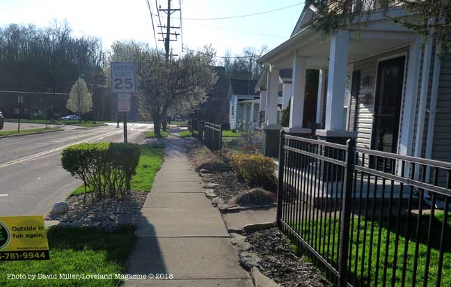
Light colored 4′ tree-shaded concrete sidewalks where children can walk without shoes, and people walk their dogs will be replaced with a 12’ barren swath of black, heat-absorbing asphalt the width of a one-lane road just feet from homes.
Light colored 4′ tree-shaded concrete sidewalks where children can walk without shoes, and people walk their dogs will be replaced with a 12’ barren swath of black, heat-absorbing asphalt the width of a one-lane road just feet from homes where owners will pay higher air-conditioning costs.
There has been no recommendation to forward the proposal to the Planning and Zoning Commission, Tree and Environment Committee, Beautification Committee, or Safety Service & Street Improvement Committee for review. No public hearings are scheduled. None have been suggested.
Phelps and City Manager Dave Kennedy have attended workshop/training on a Federal grant program along with a meeting with OKI officials to discuss the city’s project in more detail. While the updated cost estimate is being secured, the grant application is being reviewed and various needed documents are prepared. They plan to ask City Council in May to move forward seeking funding.
Phelps said that people who are using the bike trail are using too many of the downtown parking spots and using them for too long a period of time. “This is going to give them another place to get on the trail, better parking, easier on and off.” He believes the bike road will bring in new customers to Loveland Madeira Road businesses when they park nearby but head into Historic Downtown. The study does not contain any data on the potential number of users, nor potential customers to Loveland Madeira Road businesses. The study also does not address any potential negative repercussions on the residential neighborhood of Main Street or the Business/Residential neighborhood on West Loveland Avenue.
Some “Progressives” may love the idea, some may like it but believe it ill-considered given the impact on individuals who live or have invested in the impacted area. Some money conservatives may believe it an economic boon to both the Historic District and Loveland Madeira Road. Some money crunchers may ask, where is the cost-benefit analysis and just how many people will actually use it and spend money along Loveland Madeira Road. Some may ask if all costs factors have been included in the early estimate and if the price tag goes north after a grant is awarded – who will get stuck.
Elliott said his email to City Hall, that included the City Manager, Mayor and Council, the Planning and Zoning Commission, the Recreation Commission, and the Streets and Public Safety Committee was his attempt to open a dialogue between the decision makers, and those “of us” who will be financially and personally affected.
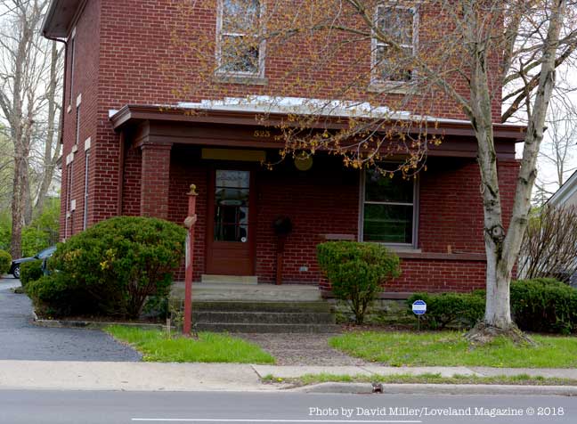
Resident and business owner Paul Elliott bought this business building on West Loveland Avenue in 1997. He has asked City Hall how the proposed connector path will affect the front yard of his property.
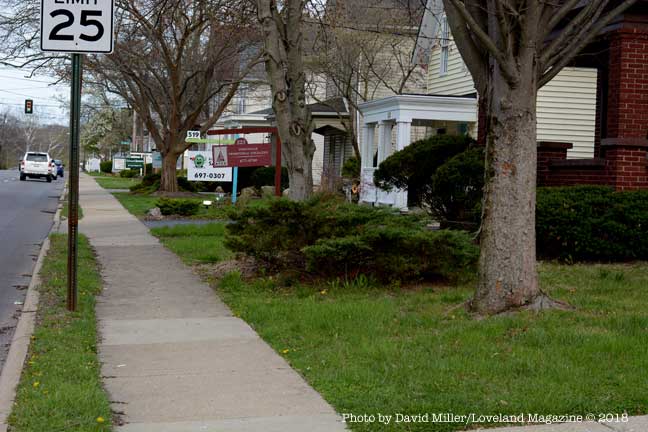
This is a view of business and residential properties on the South side of West Loveland Avenue. Although the proposal isn’t clear, presumably this 4′ concrete sidewalk will be replaced by a 12′ wide swath of asphalt, equivalent to a one-lane road. These street trees will with be cut down or have their roots severely damaged by the excavation. It is not clear whether the grassy strip will remain.
Another view of the beauty salon on the North side of West Loveland Avenue where construction of a 12′ wide swath of asphalt would require the removal of the front porch of this business. The entry to the basement of this business is through the porch floor.
If the 12′ wide bike road wraps around this building this sign and landscaping will have to go. The sign may need to be replaced with two signs to satisfy the business owner, yet there is no apparent budget item for moving or replacing business signs in the proposal.
Depending whether the 12′ bike road goes down this side of Main Street, these street trees may be removed. These utility poles if moved to the left would might result in fatal topping of the trees. If the poles remain in place it puts the asphalt even closer to the house. If the road goes on top of the tree roots the trees will shortly die. The owners will pay higher air-conditioning cost without their shade trees. If the trees die because of the location of the bike road, the home owner will then be required to pay to have the tree removed. Will the homeowner’s brick wall survive the project?
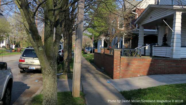
This is another problem area on Main Street where homeowners will lose a good portion of their already small front yard.
The 12′ bike road could cut across the front yard of this Main Street home taking out a tree and landscaping.
Another front porch, this one on Main Street may stand in the way of the 12′ wide asphalt bike road or end up only inches away.
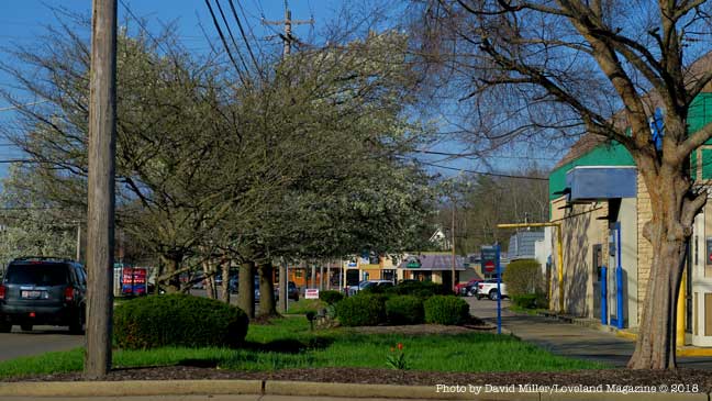
If the 12′ wide asphalt bike road goes down this side of Main Street it will leave the Artists Studios on Main without street trees and much needed parking.
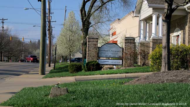
The landscaping, street trees, utility polls, and sign at this business on Loveland Madeira Road appear to be in the path of the 12′ wide bike road.
This landscaping area that softens the appearance of this automobile dealership on Loveland Madeira Road will be replaced with a 12″ asphalt bike road.
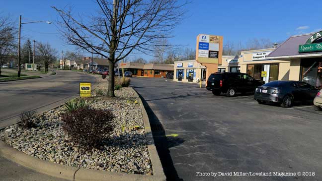
This is more of the landscaping along Loveland Madeira Road that will be removed (or most of the parking lot) to make room for a 12′ asphalt bike road.
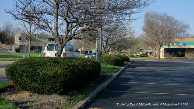
This is the only green space at the Chase Bank on Loveland Madeira Road. There will be a 12′ asphalt bike road running down the middle of it.
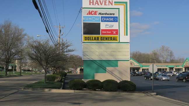
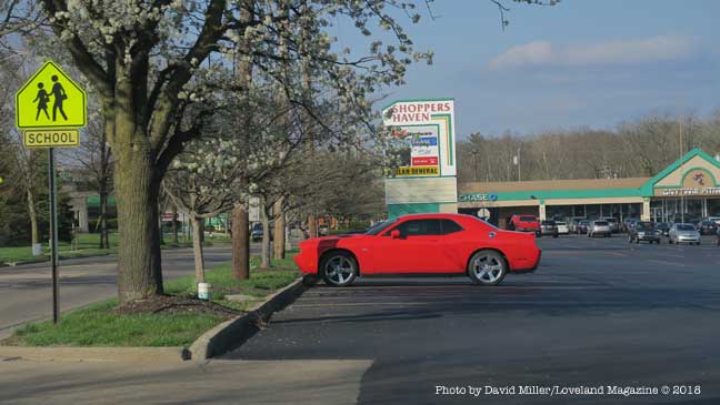
If a proposed 12′ wide asphalt bike road goes past Shoppers Haven shopping center these street trees may be removed, utility lines moved, parking spaces removed, or all three. Private property may have to be acquired through “willing seller – willing buyer” agreements or “taking” by eminent domain and associated legal costs. In the end, these parking spaces used by local businesses and the schools may be eliminated for the prospect of freeing up parking spaces a mile away in Historic Downtown.
There does not appear to be a budget item for moving this business sign out of the path of the proposed 12′ wide asphalt bike road, nor is there any discussion of whether the owner and the businesses would want their sign moved further away from the visibility of automobiles on Loveland Madeira Road.
If a proposed 12′ wide asphalt bike road goes past Shoppers Haven shopping center these street trees may be removed, utility lines moved, parking spaces removed, or all three. Private property may have to be acquired through “willing seller – willing buyer” agreements or “taking” by eminent domain and associated legal costs. In the end, these parking spaces used by local businesses and the schools may be eliminated for the prospect of freeing up parking spaces one mile away in Historic Downtown.
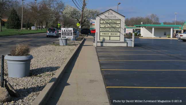
Will the landscaping and street buffer, the business sign and the parking at the 910 Building be sacrificed to free up an un-estimated number of parking spaces for the businesses one mile away in Historic Downtown?
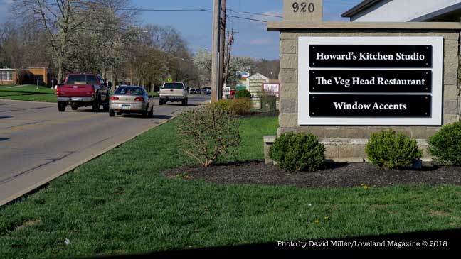
Another Loveland Madeira Road business sign in the way of a proposed 12′ asphalt bike road. Is this sign still going to have the same visibility if it is relocated? Is there enough room to just push it closer to the building or will it need to be re-engineered, and reconstructed smaller?
This is the hillside in front of New Hope Baptist Church where City Hall wants to build a 12′ wide asphalt bike road. Its there money in the estimate of cost to build a retaining wall or will the hill just get steeper?
This is Loveland Madeira Road looking North from New Hope Baptist Church toward Kroger. The guard rail protects motorists from a steep immediate drop into a very deep ravine. The 350′ long stretch quickly drops 50′ below the grade of the road. It is not clear if the budget estimate has taken into consideration the expense of building a 12′ wide bike road at the edge of this ravine.
![[Video/Photos] The Covid 5/19 High Water](https://lovelandmagazine.com/wp-content/uploads/2020/05/feature-covid-flood.jpg)


 by David Miller, Publisher