In an expected move, the U.S. Supreme Court on Friday sent back an Ohio congressional redistricting appeal for reconsideration by the state’s highest court.
Following its decision in Moore v. Harper, in which a majority of the court rejected the concept of the independent state legislature theory, the court entered a short order regarding the Ohio case, directing the state supreme court to reconsider the case “in light of Moore v. Harper.”
The Moore v. Harper decision essentially rejected all of the arguments attorneys for Huffman and GOP leadership made for legislative authority over district maps.
Using a very old and often rejected legal theory, arguments were made in the North Carolina case that a state legislature holds power over the administration of elections, therefore rise above the scrutiny of the judicial system when setting voting districts.
SCOTUS Chief Justice John Roberts said the Elections Clause of the U.S. Constitution “does not insulate state legislatures” from judicial review.
But the Ohio case, listed under the lead parties Senate President Matt Huffman and district map challenger Meryl Neiman, is headed back to a state supreme court with a new chief justice, one who led the dissent in each of the court’s rejections of congressional (and, for that matter, statehouse) redistricting maps, leading to the appeal sent to the U.S. Supreme Court.
Chief Justice Sharon Kennedy would have upheld the very first map presented to the court nearly two years ago, and every map thereafter.
Freda Levenson, legal director for the ACLU of Ohio said Friday that if Moore v. Harper is applied correctly by the Ohio Supreme Court, the court would uphold its previous decision, rejecting the current congressional maps.
“What SCOTUS said in Moore was that legislatures must follow their state constitutions — consistent with what the Ohio Supreme Court already decided,” Levenson said.
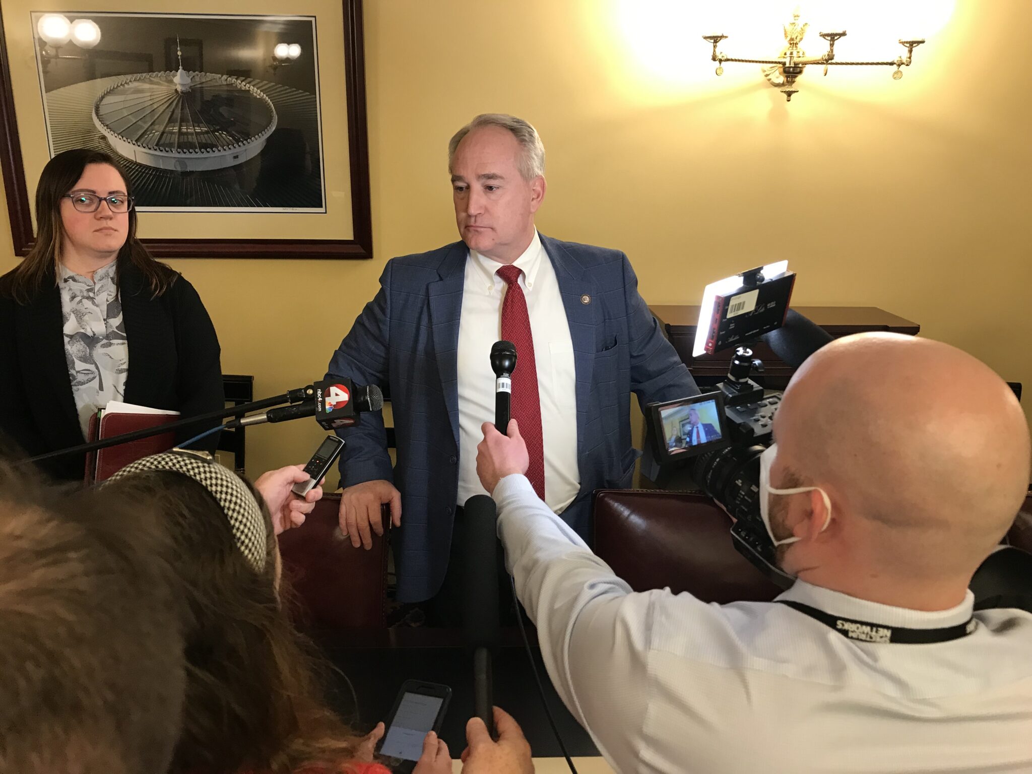
Before the court made either decision regarding redistricting, Huffman told reporters it “may simply be that we have the same congressional districts for the 2024 race as the one we have now.”
Regarding the SCOTUS decision, Huffman released a statement on Friday praising the court’s move, and saying the appeal “clearly recognized serious constitutional concerns with the narrow majority opinions rendered under the former Chief Justice.
“We are reviewing the U.S. Supreme Court’s message to determine the path forward,” Huffman said in a statement.
The Ohio Redistricting Commission would need to be reconvened by Gov. Mike DeWine, but a spokesperson for the governor suggested that won’t happen until after the state budget is finalized.
Also of note is DeWine’s son, Pat DeWine, who is a sitting justice on the supreme court. Pat DeWine has recused himself from previous cases in which the court considered contempt proceedings on ORC members (including DeWine) for missing redistricting deadlines, but has not recused himself from general redistricting lawsuits coming before the state supreme court.
SUSAN TEBBEN
Susan Tebben is an award-winning journalist with a decade of experience covering Ohio news, including courts and crime, Appalachian social issues, government, education, diversity and culture. She has worked for The Newark Advocate, The Glasgow (KY) Daily Times, The Athens Messenger, and WOUB Public Media. She has also had work featured on National Public Radio.
A federal three-judge panel still waiting on an Ohio legislative redistricting plan said Tuesday it won’t jump into congressional redistricting right now either.
Chief Judge Algenon Marbley and judges Amul Thapar and Benjamin Beaton, representing the U.S. District Court’s Southern District of Ohio said a request by two Youngstown voters to wipe out the congressional maps “exceeds the scope of their intervention.”
“The court did not contemplate sweeping congressional redistricting, which is a wholly distinct process, into this lawsuit,” the judges wrote in a decision filed Tuesday.
The voters, represented by attorney Percy Squire, wanted the most recent congressional maps to be removed, arguing GOP mapmakers did not include racial data when drawing district lines, thus discriminating against marginalized Ohioans. Their arguments were added by the judges to another lawsuit filed by GOP voters. That lawsuit specifically addressed legislative districts, and asked that a legislative map rejected by the Ohio Supreme Court be used in the May 3 primary.
The congressional map, which was passed by the GOP-controlled Ohio Redistricting Commission last month, hasn’t been rejected by the Supreme Court, unlike previous versions of the map. The state’s highest court rejected a challenge to the maps, with justices saying a new lawsuit would need to be filed to bring jurisdiction of the maps back to the court. Those new lawsuits came in quickly after the court’s ruling, but since then, the ACLU chose to challenge the map for the 2024 election rather than 2022, effectively opening the door for the maps to be used in this year’s election.
Congressional races were included on ballots for the May primary, for which absentee and early voting has already started.
The federal judges said claims to change congressional redistricting plans “would not have passed this court’s intervention analysis” in the first place, despite the fact that both plans came through the Ohio Redistricting Commission.
“Though both varieties of redistricting involve the commission, they are separate tasks utilizing independent standards and resulting in different district boundaries for General Assembly members versus Congressmembers,” the three-judge panel ruled.
The best course of action for the Youngstown residents was to file a new lawsuit in the Northern District court (the federal court closest to Youngstown) and start the process over again, the judges wrote.
That said, the judges allowed the residents to stay in the lawsuit still being decided by the federal court, “for the purposes originally identified: addressing their constitutional challenge to the remedy or remedies sought with respect to the General Assembly redistricting.”
The federal court has given the state until April 20 to resolve legislative plan issues, which includes hearing a decision from the supreme court on the newest legislative maps, which only are slightly different from the third map rejected by the Supreme Court.
Also open-ended at this point is the possibility of a contempt hearing for members of the redistricting commission, for which the Supreme Court asked for reasoning as to why the members shouldn’t be held in violation of orders from that court. The GOP redistricting members have said contempt wouldn’t be appropriate because they passed a map before the deadline.
Four Republican members of the Ohio Redistricting Commission passed a third round of legislative maps Thursday, exactly one week after the Ohio Supreme Court’s deadline passed.
The maps just introduced Thursday afternoon passed with a 4-3 vote, with both Democrats voting against as with previously passed maps.
The House map presented on Thursday shows a 54-45 GOP advantage in the House and an 18-15 advantage in the Senate. While 19 of the Democratic House districts and seven in the Senate are considered competitive political “toss-ups” in the 50% to 52% advantage range, none of the Republican districts are, with all of them having a Republican advantage more than 52%.
Auditor Keith Faber was the lone Republican to vote against the maps, which he said is for the same reasons he didn’t support the Democratic maps last week.
“I think there are some issues that I have concerns with and so for that reason, I didn’t think, to be consistent, I could overlook them in this map,” Faber said.
Those issues included compactness and political subdivision splits.
The Ohio Senate districts as shown on the newest GOP redistricting proposal. The map was brought forward Thursday during a meeting of the Ohio Redistricting Commission. Source: Ohio Redistricting Commission
“I understand the desire to have a map, I understand the desire to send a map to the supreme court that they will uphold, but again, I’m not going to violate my view of the constitution merely to get a map done,” Faber said.
While the Ohio Redistricting Commission originally met this week to talk congressional maps, for which they have another few weeks to meet the supreme court deadline, legislative maps took the attention away.
Senate President Matt Huffman joined with Gov. Mike DeWine and Faber in bringing up the legislative matter amidst talks on congressional district lines.
The commission is constitutionally required to use statewide state and federal elections data from 2016 to 2020 to come up with the data for their maps.
The passage comes mere days before the commission members must appear before the supreme court and answer for missing the deadline of Feb. 17.
The Ohio House districts as shown on the GOP map proposal presented during a Thursday meeting of the Ohio Redistricting Commission. Source: Ohio Redistricting Commission
The court asked for all members to come to a March 1 hearing on the possibility of contempt of court for ORC members.
The commission members adjourned a meeting that deadline day with no maps approved. GOP leaders, including commission co-chair House Speaker Bob Cupp, said no agreement could be made and compliance with the orders of the court and the Ohio Constitution weren’t possible in the 10 day window they were given after the last legislative maps were struck down.
Democrats maintained throughout Thursday that they were left out of the process, and the map that Republicans presented does not address toss-up districts.
“We have been and continue to be willing to work with them if they want to collaborate at any time to produce a commission map,” co-chair state Sen. Vernon Sykes, D-Akron.
In their statement supporting their maps, the GOP refuted the Democratic comments.
“The final adopted plan contains input from those members of the commission, directly or through their staff, who chose to participate,” Cupp read from the statement.
Without bipartisan agreement, if the supreme court accepts the maps this time around, they will last four years.
After the maps were passed, Secretary of State Frank LaRose asked the commission to allow him to distribute a statement for candidates whose residency might change because of the district changes.
Now the commission will move back to congressional maps. Cupp said the commission plans to meet on Tuesday, the same day as their contempt hearing.
In committee hearings Wednesday, Republican lawmakers in the House and Senate unveiled their plans for new congressional districts.
In both cases Democrats complained the maps were shared at the eleventh hour, leaving members unable to properly analyze the proposals before them. Procedural votes along partisan lines and unanswered questions about the drafters’ intent seem to presage a bitter fight more likely to produce a lengthy court battle than a 10 year congressional map.
Consequences
Pictured is Ohio’s congressional delegation as it has looked after the 2012, ’14, ’16, ’18, ’20, and ’21 elections. (Click to view larger map)
Ohio Republicans have had a 12-4 advantage in congressional districts since the maps were last drawn in 2011, with no congressional seats flipping parties in any election since that time. Ohio lost one district in the 2020 U.S. Census, going from 16 down to 15.
Both the House and Senate GOP maps would incorporate large swaths of Republican territory into Toledo Democratic U.S. Rep. Marcy Kaptur’s district effectively rendering it a Republican district. Kaptur said in a statement that fair districts are a foundational requirement of the American Republic, assuring that the voices of all people are able to influence government.
“Lawmakers should not be able to insulate themselves from the views of their constituents through a rigged system of gerrymandering,” she said. “The proposals unveiled today are a clear violation of this most basic principle.”
The House map splits Hamilton, Franklin, Cuyahoga and Summit counties all into three districts. In Summit, one stretches up to Lake Erie communities such as Ashtabula, and another stretches down to the Hocking Hills area of Southeastern Ohio. In Franklin County, the city of Westerville is moved into the district currently occupied by Republican U.S. Rep. Jim Jordan, and in Hamilton County, Democratic Cincinnati is slimly connected to the entirety of Republican Warren County.
The Senate map also splits Hamilton, Franklin and Cuyahoga counties into three districts, with Democrats holding the advantage in the city centers and Republicans having the advantage in the respective other two districts including parts of each county. This map also moves a significant portion of Franklin County into Jim Jordan’s district. The Senate GOP map also includes most of Montgomery County, home of Dayton, and Republican Warren County in the same district.
The House proposal
The guiding principle behind the House map appeared to be plausible deniability. North Canton Republican Scott Oelslager delivered pre-drafted remarks describing how his map complied with new constitutional demands, but he balked at almost every question about his proposal.
The Ohio House Republican proposed U.S. Congressional District map. From the Ohio House of Representatives. (Click to view larger map)
He affably ducked questions from Democratic members as too “technical”, and acknowledged House staffer Blake Springhetti handled the actual drafting of the map. Speaking after the hearing, he admitted even his remarks weren’t all his own — Springhetti helped come up with those, too.
Pressed by Rep. Tavia Galonski, D-Akron, about whether he’d object to Springhetti testifying about the proposal, Oelslager dodged.
“That’s a decision that will be made by leadership above me and counsel,” he said.
Asked more generally by Rep. Richard Brown, D-Canal Winchester, whether his party is even seeking a ten year map, which would require the support of at least a third of Democrats, Oelslager again deflected.
“That’s actually a decision that I’m not involved with; I have not had any discussions with anybody, and I believe that will be a decision made above my pay grade in this process,” Oelslager said.
Every member of the House leadership team, save the speaker, serves on the Government Oversight committee where Oelslager presented his proposal.
Democrats raised objections early, noting the 300 page substitute amendment and Oelslager’s testimony were posted less than 20 minutes before the committee began. Once the documents were shared, the maps were presented in a format that made rapid analysis difficult.
But Democrats did voice concerns about the most obvious potential problems such as the four counties — Hamilton, Franklin, Cuyahoga and Summit — being split among three different districts. Another district runs from Ohio’s southernmost county along the eastern border all the way past Youngstown in the northeast corner of the state.
Despite sidestepping questions on how borders were determined, Oelslager did share a rundown of partisan performance. He described the breakdown as 8-5-2, where Republicans would have eight safe seats, Democrats would have two and five would be a “toss-up.” That toss up range is broad, though, with the majority party having as much as 55% of the likely vote share and the minority having at least 45%.
But outside observers dispute Oelslager’s analysis. The partisan lean metrics in Dave’s Redistricting App suggest the House Proposal would give Republicans a strong advantage in 9 districts, not 8. Four of the remaining districts would be considered competitive based on a 45-55% split, and two would be safe Democratic seats.
Shortly after the committee, Ohio League of Women Voters executive director Jen Miller criticized a lack of transparency in the process. Without maps available ahead of time, she said, it’s impossible to know how good or bad the lines might be.
“We want to think about voters in all 88 counties and how they’re represented and what they need. We can’t do that yet. It’s going to take us quite some time,” Miller explained. “But we certainly are concerned that we could not get the map in a timely fashion, and we are concerned that we are once again maybe running out the clock. Estimates do look as though it is not partisan balanced, which is one of the things I think voters really wanted.”
The Senate proposals
The Senate Local Government and Elections Committee heard about one map that’s been out since the end of September, and another that made its debut during the committee meeting.
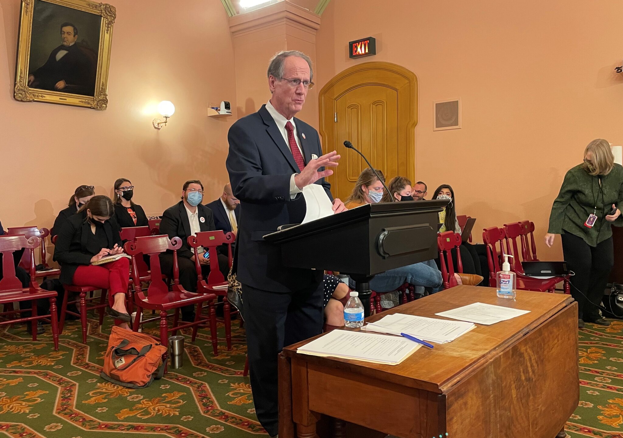
State Sen. Rob McColley, R-Napoleon, presents the Senate GOP map in Local Government & Elections Committee on Wednesday. Photo by Susan Tebben, OCJ.
Premiering Wednesday was the Senate GOP’s congressional map, presented by state Sen. Rob McColley, R-Napoleon.
“We wanted to be sure that we put out a map that we were comfortable standing behind and that we felt gave us an opportunity with the minority party to meet and discuss that,” McColley said after presenting his map.
McColley said he was the lead on the map “concepts,” but Ray DiRossi, senate budget director and legislative map-drawer, was the one to insert the concepts into mapping software.
In the Senate Republican map, McColley said 14 counties are split, with the three biggest counties — Cuyahoga, Franklin and Hamilton — split twice.
The Senate GOP map proposal has six Republican-leaning districts, 2 Democrat-leaning and seven that would be competitive, which McColley also defined as being within the 45-55% range.
Statewide election data and constitutionally required data was used in the maps, however McColley said racial data was skipped in the GOP map, something Republicans were criticized for in the legislative map-drawing process.
The Ohio Senate GOP’s proposed U.S. Congressional district map. From the Ohio Senate. (Click to view larger map)
DiRossi told the Ohio Redistricting Commission during his presentation of those maps that racial and demographic data was skipped deliberately at the direction of “legislative leaders.”
Criticism of the maps was limited, mostly because of the abrupt timeline in receiving the GOP map, but an overarching look at the maps gave University of Cincinnati politics professor David Niven a look into political strategy, he said.
“It is an astonishing work of defiance of the constitution, an astonishing defiance of voter will,” Niven said.
Niven said the splitting of counties is at times confusing, which he thinks is a political strategy as part of the maps.
“The effect of this is (voter) confusion and dampened representation,” Niven said.
Collin Marozzi of the ACLU of Ohio said he was still reviewing the Senate effort, but from a brief look during the committee meeting, it didn’t surprise him to see Republicans making the decisions they made, but he wanted to hear more about why.
“It’s deliberate choices, they made their choices and I think the people of Ohio deserve to have an explanation as to why they made them, not just the fact that they did or didn’t make them,” Marozzi said.
State Senate Minority Leader Kenny Yuko and state Sen. Vernon Sykes presented the Senate Democratic Caucus map officially to the commission, with policy advisor Randall Routt jumping in with breakdowns directly from the map.
“As elected leaders, we owe it to our constituents to produce fair maps,” Yuko said. “Let’s work together, and let’s get this mission accomplished.”
The Democratic map came just before the Oct. 1 deadline for the legislature to approve congressional redistricting maps the first time, which blew by without any significant action from either General Assembly body.
The deadline passed, and the process moved to the Ohio Redistricting Commission, on which Sykes sat as co-chair, and their Oct. 31 deadline came and went without any map approval.
In Wednesday’s committee meeting, Routt said the map was “merely a starting proposal” but a proposal they felt complied with not only the Ohio constitution, but the salvaging of communities across Ohio.
The Ohio Senate Dems proposed congressional district map. (Click to view larger map)
In explaining the map, Routt said only 11 counties were split, with the splits only occurring once in each county. No counties were split more than once.
“We attempt to keep communities together in our map, and we think that’s an overriding state objective,” Routt told the committee.
Committee member state Sen. Tina Maharath, D-Canal Winchester, took time to ask if Democratic bill sponsors felt the redistricting process had met expectations. Yuko and Sykes both said no, and Sykes said with no GOP map to consider until Wednesday, it’s been difficult to negotiate a ten-year plan with bipartisan agreement.
“We’re at this third stage of this process and fortunately it looks like today … we’re starting out hopefully with a plan, and maybe we’ll be better able to negotiate a bipartisan deal,” Sykes said.
McColley said concerns about transparency are not necessarily well-placed, and likened the process to creating a piece of legislation, in that some preparatory conversations “don’t happen in the public.”
“Usually there’s a public proposal … and then we’ll have a proposal and a process going forward to work off of, and that’ll inform much of the public dialogue that occurs with this map,” McColley said.
All three maps are the subject of scheduled public hearings Thursday morning in Senate Local Government and Elections and House Government Oversight.