Reuters has announced that President Joe Biden will join Republican Senate Minority Leader Mitch McConnell in a Wednesday event in Kentucky aimed at highlighting the effects of the $1 trillion 2021 infrastructure bill, a White House official said Sunday.
Bidenr, along with Ohio Governor Mike DeWine and Kentucky Governor Andy Beshear, are to appear at a ceremony highlighting the $1.64 billion in funding awarded to for the Brent Spence Bridge Corridor Project connecting the two states across the Ohio River.
Ohio Governor Mike DeWine and Kentucky Governor Andy Beshear announced last week the awarding of federal funding grants worth $1.635 billion for the Brent Spence Bridge Corridor Project – giving the landmark bridge and corridor project the green light to move toward construction.
“Ohio and Kentucky have been discussing the Brent Spence Bridge Corridor Project for almost two decades, and now, we can finally move beyond the talk and get to work,” said Governor DeWine. “This project will not only ease the traffic nightmare that drivers have suffered through for years, but it will also help ensure that the movement of the supply chain doesn’t stall on this nationally significant corridor. My administration vowed to press the federal government to fund this project, and we’re glad that they have recognized its significance. I’m grateful to the teams in both states who have worked so hard to make this project a reality.”
With funding secured, groundbreaking on the project is anticipated for late 2023, with substantial completion slated for 2029.
“I’m thrilled the time has finally come for us to get the companion bridge built,” Gov. Beshear said. “Funding and constructing the Brent Spence Bridge Corridor Project is more than the fulfillment of my administration’s promise – it’s a dream-fulfilled for the thousands of travelers who pass through the bustling region every day waiting eagerly for traffic relief to come on this nationally significant corridor. It also shows what’s possible when we prioritize people over politics. Once complete, drivers will have a more enjoyable and efficient drive and we’ll have the infrastructure in place to support the booming economy in this part of the state. Hats off to the Kentucky Transportation Cabinet and Ohio Department of Transportation, and countless partners and advocates who played a role in today’s monumental achievement including the General Assembly for the last budget allocation. We greatly appreciate President Biden and Secretary Buttigieg for this historic investment.”
The Brent Spence Bridge was constructed in the 1960s to carry around 80,000 vehicles a day, but the daily I-75 and I-71 traffic load has reached 160,000 vehicles in recent years. Because I-75 is a key freight corridor stretching from Canada to Florida, the congestion impacts commerce and commuters who travel the corridor in the eastern United States.
Project plans call for the construction of a companion bridge to the west of the existing Brent Spence Bridge, as well as improvements to the current bridge and the roadway network that ties into each river crossing. There will be enhanced pedestrian access across I-75 in Cincinnati to reconnect downtown with western neighborhoods and the City of Cincinnati will regain nearly 10 acres of land to develop in the downtown area. In Kentucky, the project will include a new storm sewer system to reduce flooding and improve local roads, including enhanced pedestrian and bicycle facilities, in the area of the existing and new bridge.
The project team – consisting of representatives from the Ohio Department of Transportation (ODOT) and Kentucky Transportation Cabinet (KYTC) – applied jointly for funding and have outlined terms to move the project to construction.
The funding was made available through the passage of the federal Bipartisan Infrastructure Law that invested billions of dollars to revitalize infrastructure and spur the economy.
In July, Governors DeWine and Beshear announced revised plans based on community engagement and technical analysis to shrink the project footprint.
“Nothing great is achieved alone and I’m proud of all the people who’ve come to the table over the years to ensure that we’ll deliver a project with huge benefits and minimal impacts to the communities that live in and around the project area,” KYTC Secretary Jim Gray said.
“This project doesn’t just move vehicles, it moves people. We’re able to reconnect neighborhoods to downtown Cincinnati, improve safety, and reduce congestion on this route, all while only adding a single lane to the interstate with this project,” said ODOT Director Jack Marchbanks.
With funding secured, groundbreaking on the project is anticipated in late 2023 with larger construction activities in 2024. Substantial completion on the project is slated for 2029. The immediate next step will be the selection process to determine the Progressive Design Build contractor team to complete the project. That effort will begin in January when the Request for Proposals (RFP) is released to the contractor community.
The Federal Highway Administration recently required the project team to complete an analysis to better identify project cost estimates. Through this process, the project team determined the project is likely to cost about $3.6 billion. The increase from previous estimates was not unexpected due to the recent impact of inflation in construction prices. As a result, the project team is updating the project’s financial plan to account for the change.
The Brent Spence Bridge Corridor Project will invest in local communities panning eight miles between the Western Hills Viaduct in Ohio and Dixie Highway in Kentucky, the project will address the second-worst truck bottleneck in the nation by improving safety and travel on the interstate connection that carries more than $700 billion worth of freight every year.
Miami Township, Ohio – Phillip Sullivan made an emergency landing of his Piper airplane on Deerfield Drive in the Miami Trails subdivision while returning from Wadsworth, Ohio to his hometown of Louisville, Kentucky on July 18. He was on a Pilots-N-Paws flight and had delivered puppies to the northern Ohio town that is South of Cleveland.
The incident report was recently released by the National Transportation Safety Board (NTSB). Sullivan told Loveland Magazine on Wednesday, “The plane had unrepairable damage to the main fuselage so it’s being parted out.”
Sullivan was flying his single-engine, fixed-pitch, 150 horse-power, four-seater Piper model number PA 20/22 made in 1965. There were 2,865 hours on the engine at the time of the crash (5:30 PM) and 1,600 hours since it was last overhauled. The last time of an annual inspection was March 4, 2020. The plane had an Emergency Locator installed and it was operating at the time of the crash, however, the report says it did not aid in landing the aircraft. There also was an Automatic Dependent Surveillance-Broadcast System aboard as well as a hand-held GPS device.
Twenty-one-year-old Sullivan of Louisville owned the craft and was the pilot. There were no injuries. Sullivan has a “Private” pilot certificate. He had a 3-point restraint system onboard, however was only using a lap-belt. There were no inflatable restraints on the aircraft. The last time Sullivan had a “flight review” was March 30, 2019. He has recorded a total of 528 flight hours and 168 hours on the plane that crashed. He also has a helicopter rating and has flown a rotorcraft for 71 hours.
“The problem stemmed from my fuel gauge,” said Sullivan. “Both fuel gauges evidently are empty when they say 1/4th of a tank, something the previous owner didn’t disclose to me. One-fourth of a tank is about 9 gallons in a Piper model number PA 20/22, leading me to believe I had close to 18 gallons on board when the engine quit.”
Sullivan left Wadsworth, Ohio at 2:15 PM and the destination was Cincinnati Municipal Airport-Lunken Field. The sky was listed on the report as “Clear” and VMC, which refers to conditions that permit a pilot to maintain visual reference with a horizon and provide enough visual references by which he or she can navigate. The report says that visibility was 10 miles.
Sullivan was at an altitude of 2300 feet MSL (mean sea level) and 10 miles out from Lunken Field and was cleared to land when the engine started to lose power.
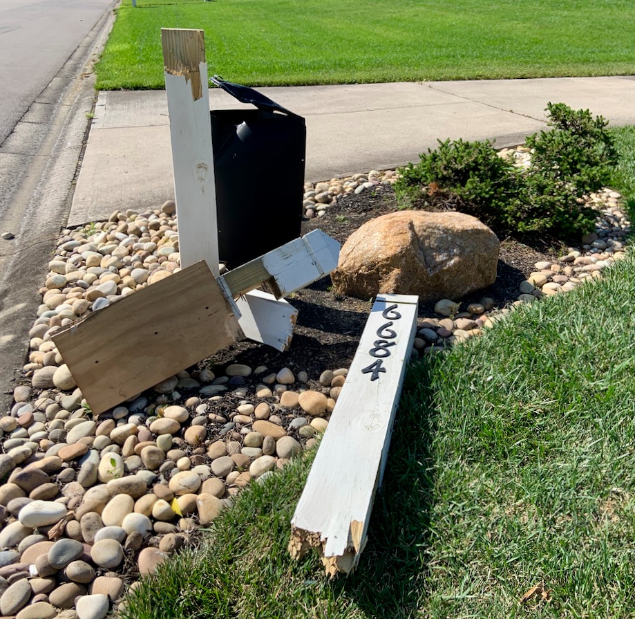
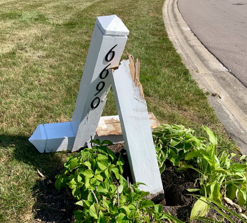
The left-wing was destroyed. The right-wing had a small tear in the fabric. The bottom right cowling was “smashed”. The fuselage above the right seat was bent. The right horizontal stabilizer and tailwheel were bent. The total damage is listed as “substantial” in the report. The aircraft hit three mailboxes, one light pole, and damaged one tree.
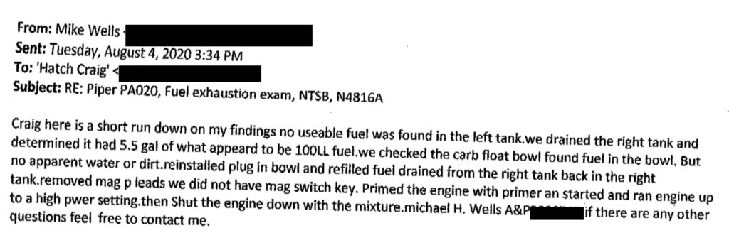
The mechanic that inspected the engine for NTSB said in his report that the tanks were “sumped” showing no contaminates in the fuel. He said that no fuel remained in the left tank, however, he found 5.5 gallons in the right tank. He drained the tank, put the fuel back, in and had no difficulty starting the engine.
In the narrative section of the report, Sullivan told investigators that the flight was uneventful until the engine quit close to Lunken Field. He said that the terrain was heavily residential and that he attempted to land in a golf course but large hills forced him to divert to a secondary landing area – the subdivision road. “The road was slopped downward and a 30′ obstacle (trees) at the beginning of the road.” He believed the error occurred when he used “1/4 on the fuel gauge” to fuel up the aircraft. “I incorrectly assumed 1/4 meant 1/4 of the way full, instead as I learned the hard way, 1/4 on the fuel gauge means empty, so when I added 15 gallons of fuel at the start of my flight, I only had 15-18 gallons onboard instead of the 24 gallons.”
The narrative continued in the Operator/Owner section with Sullivan concluding that the cause of the engine failure was fuel exhaustion and he can avoid the problem in the future by creating a fuel dipstick. “Fuel gauges cannot be trusted,” he said.
Sullivan told Loveland Magazine that he believes due to the incident there will be an airworthiness directive released on the specific fuel gauge used in his airplane.
Sullivan said that because of the unrepairable damage to the main fuselage of his plane, “It’s being parted out. Due to the high cost of aviation, I’m out of aviation for a while. Volunteering is still a priority for me and I’ve found other ways to volunteer my time towards charity.”
“The best way for present and future pilots to prevent this is to create and use a dipstick. It’s not something taught in flight school and very well should be taught,” said Sullivan. He described the dipstick he should have been using:
“A dipstick is a wooden stick, usually larger than 2 feet. With intervals written on it. E.t. 4gal, 8gal, 12gal, 16gal, 20gal. Using this before each flight tells you exactly how much fuel is in your tank and you don’t rely on fuel gauges.”
Loveland Magazine has reached out to the NTSB to find out what will be the next steps in their investigation and when a final report will be issued and will update this story when more information becomes available.
Here is the MECHANIC REPORT:
N4816A Accident Investigation Notes
On scene:
Damage sustained to the left wing forward and aft spars, leading edge and forward lift strut.
Damage to the right wing by the tip bow, fabric torn.
Damage to the right side forward cowling.
Damage to the right horizontal stabilizer and elevator. Both were bent up.
Damage to the cockpit upper center section.
Fuel selector in the off position.
Missing the aircraft airworthiness certificate.
Missing the aircraft weight and balance.
The aircraft hit three mail boxes, one light pole, and damaged one tree.
All tanks were sumped showing no contaminates in the fuel.
The aircraft landed
The aircraft came to rest in a heading of 106 degrees. Interview:
Aircraft was fueled at 3G3 where 7.5 gallons was added to each tank (16 gallons total).
He did not have a dip stick for this aircraft to see how much was in each tank. He based the fuel quantity off of the gauges.
He said the fuel gauges were both reading 1⁄4 tank prior to adding fuel.
He planned the trip at a cruise of 2350 RPM with a seven to eight gallon burn.
He planned on the trip from 3G3 to LUK to take 1.57 hours.
He always starts off on the left tank per the AOM.
Switches tanks every 10 minutes while en-route. He was not sure if he did this consistently during this flight.
Mid way he heard a thud and was not sure what it was. There was no changes in engine indications.
He was at an altitude of 2300 feet MSL and 10 miles out from LUK and was cleared to land when the engine started to lose power.
He was not sure what tank he was on when the issue occurred.
He said the engine started to lose power and then started to come back when it then quit.
He did not remember when he had a full loss of power.
He attempted to restart the engine multiple times with no luck.
He followed the checklist.
He did not feel that he moved the fuel selector to the other tank during the engine failure.
He was not sure if the propeller had stopped spinning.
He was planning on landing at a golf course and determined he was not going to be able to make it and chose the road.
Active children and adults, people with heart and lung disease, including asthma, and older adults should reduce prolonged or heavy outdoor exertion.
Air Quality Forecast is 105 AQI for Thursday, July 17
The Southwest Ohio Air Quality Agency has issued an Air Quality Alert for Friday, July 17 for Butler, Clermont, Hamilton, and Warren counties in Ohio; Boone, Campbell, and Kenton counties in Kentucky; and Dearborn County in Indiana.
You can help protect those most vulnerable
• Take the bus, carpool, bike or walk instead of driving
• Refuel your vehicle after 8 p.m.; do not top off when refueling and tighten the gas cap
• Avoid idling your vehicle
• Combine trips or eliminate unnecessary vehicle trips
• Keep your vehicle maintained with properly inflated tires and timely oil changes
• Avoid use of gasoline-powered lawn equipment on Air Quality Advisory days
• Avoid use of oil-based paints and stains on Air Quality Advisory days
• Never burn leaves or other yard trimmings
• Always burn clean, seasoned wood in outdoor fire pits, fireplaces and wood stoves
• Do not use fire pits or fireplaces for non-essential home heating on Air Quality Advisory days
• Conserve electricity
You can check the current air quality by clicking on this image and entering a ZIP Code.
If you find that having this type of local news adds value to your quality of life, kindly consider contributing to the cost of producing it.
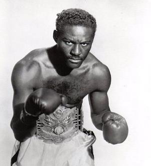
Ricky Mulvey’s Podcast: “Total Fighter” about Cincinnati’s Ezzard Charles
This podcast shines a new light on the underrated Cincinnati Cobra; the greatest light-heavyweight of all time.
Ricky Mulvey is a former sportswriter and talking head at Loveland Magazine
Part 3 of Ricky Mulvey’s 5 part podcast series on Ezzard Charles, “Total Fighter” is up now.
In the third episode, Ezzard Charles tries to move on from his tragic meeting with Sam Baroudi and the mafia tightens its grip over his boxing career. A match against Joe Louis becomes more possible after the biggest fight in Cincinnati’s history.
The Man in Front of Me (Part 3)
Total Fighter features interviews with Buddy LaRosa, founder of LaRosa’s Pizza, William Dettloff, author of “Ezzard Charles: A Boxing Life,” and Ezzard Charles II.
Episode 2: “Cobra Strike” covers Ezzard’s tragic and career-defining boxing match, his experience in World War II, and his manager who was “allegedly” connected to the New York Mafia.
Play Episode 2
Featuring interviews with P Man Jones, Ezzard Charles II, William Dettloff, author of “Ezzard Charles: A Boxing Life,” and Buddy LaRosa, founder of LaRosa’s Pizza.
“Total Fighter,” is a narrative, nonfiction podcast about Ezzard Charles, Cincinnati’s heavyweight champion, and hosted by Loveland native Ricky Mulvey.
By Source, Fair use, https://en.wikipedia.org/w/index.php?curid=42512075
This podcast shines a new light on the underrated Cincinnati Cobra; the greatest light-heavyweight of all time.
The series will ultimately follow Charles to his match against Joe Louis, and the characters who followed him– his family and the mafia.
The premier episode, “More Than a Gym Fighter” is a deep-dive into a very different Cincinnati. Go to a bustling Findlay Market in the 1940s, in between the pool tables and cigar smoke at the American Legion Hall in Newport, Kentucky for Charles’ first boxing match, and a Battle Royale in Lawrenceville, Georgia.
Play Episode 1
“Total Fighter” features interviews and stories from Buddy LaRosa, founder of LaRosa’s Pizza, William Dettloff, author of “Ezzard Charles: a Boxing Life,” Frank Wettencamp, one of Ezz’s high school classmates, and more.
This show explores his complex character; why the name “Ezzard Charles” became an insult by Frank Sinatra and an inspiration to the composer George Russell.
You can first hear new episodes and updates right here on Loveland Magazine or by following Ricky Mulvey on Facebook, @rickymulvey on Instagram, and @rickssoslick on Twitter.
You can find the show on Apple Podcasts, Spotify, or most other platforms.
Ricky Mulvey’s Podcast: “Total Fighter” about Cincinnati’s Ezzard Charles
This podcast shines a new light on the underrated Cincinnati Cobra; the greatest light-heavyweight of all time.
Ricky Mulvey is a former sportswriter and talking head at Loveland Magazine
Part 2 of Ricky Mulvey’s 5 part podcast series on Ezzard Charles, “Total Fighter” is up now.
Episode 2: “Cobra Strike” covers Ezzard’s tragic and career-defining boxing match, his experience in World War II, and his manager who was “allegedly” connected to the New York Mafia.
Featuring interviews with P Man Jones, Ezzard Charles II, William Dettloff, author of “Ezzard Charles: A Boxing Life,” and Buddy LaRosa, founder of LaRosa’s Pizza.
“Total Fighter,” is a narrative, nonfiction podcast about Ezzard Charles, Cincinnati’s heavyweight champion, and hosted by Loveland native Ricky Mulvey.
By Source, Fair use, https://en.wikipedia.org/w/index.php?curid=42512075
This podcast shines a new light on the underrated Cincinnati Cobra; the greatest light-heavyweight of all time. The series will ultimately follow Charles to his match against Joe Louis, and the characters who followed him– his family and the mafia. The premier episode, “More Than a Gym Fighter” is a deep-dive into a very different Cincinnati. Go to a bustling Findlay Market in the 1940s, in between the pool tables and cigar smoke at the American Legion Hall in Newport, Kentucky for Charles’ first boxing match, and a Battle Royale in Lawrenceville, Georgia.
Play Episode 1
“Total Fighter” features interviews and stories from Buddy LaRosa, founder of LaRosa’s Pizza, William Dettloff, author of “Ezzard Charles: a Boxing Life,” Frank Wettencamp, one of Ezz’s high school classmates, and more. This show explores his complex character; why the name “Ezzard Charles” became an insult by Frank Sinatra and an inspiration to the composer George Russell.
Play Episode 2
You can first hear new episodes and updates right here on Loveland Magazine or by following Ricky Mulvey on Facebook, @rickymulvey on Instagram, and @rickssoslick on Twitter.
You can find the show on Apple Podcasts, Spotify, or most other platforms.
EDITOR’S NOTE: In reaction to this editorial, City Council voted on Tuesday, April 24 to have a public hearing on this proposal during the City Council meeting of May 9.
It’s past time City Hall start a dialogue with those most affected
by David Miller, Publisher
Come take a walk with me while I tell you a story
It’s just my opinion, but I believe City Hall should start talking to people about this before it gets so far along people will need 1.6 million dollars worth of arguments against it. Once City Hall gets the funding for what they will describe as “Free Money” it will be extremely hard to turn council members to “No” votes. Residents should be given a fighting chance.
As the equivalent of a one-lane asphalt road that will cozy within feet of the front doors of homes and businesses in the West Loveland Historic District and along Loveland Madeira Road, and City Hall moves closer to securing funding, property, and homeowners have yet been asked their opinion. Almost all do not yet know the proposal has already been partially funded by Hamilton County and the Ohio, Kentucky, Indiana Council of Governments has committed their resources to finding 80 percent of the $1,623,000 and growing price tag for construction.
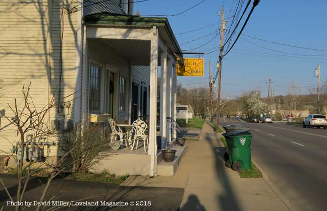
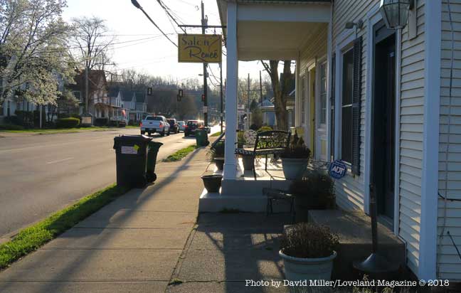
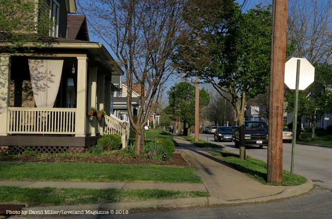
This is a view of the North side of West Loveland Avenue where construction of a 12′ wide swath of asphalt would require the removal of the front porch of this business. The entry to the basement of this business is through the porch floor.
Some front porches would have to be removed to accommodate the 12’ wide asphalt bicycle road. The road will be reduced to 10’ wide only where construction proves difficult.
As the City Hall proposal gets yet more expensive and closer to fruition there is still no initiative from the Council table to ask the thoughts and suggestions of citizens, home-owners, affected businesses, property owners, or pertinent City Commissions and Committees.
As the City Hall proposal gets yet more expensive and closer to fruition there is still no initiative from the Council table to ask the thoughts and suggestions of citizens, home-owners, affected businesses, property owners, or pertinent City Commissions and Committees.
One property and business owner along the proposed route wrote to City Hall. Paul Elliott said, “I am under the impression that such a proposal ‘has legs’, and city officials are even seeking funding sources. First, as a taxpaying resident and longtime business/property owner on West Loveland Avenue, I am disappointed that no city official has approached either the public in general nor us property owners who may be affected by such a bike corridor.”
The project, called the Loveland Connector Trail, will be approximately 1.4 miles long and will begin at the Deer Ridge II Apartments being built next to New Hope Baptist Church. It will continue along Loveland Madeira Road to Main Street, to the southern part of Wall Street, then to West Loveland Avenue, crossing over the Little Miami River at the Col. Paxton Bridge ending in Historic Downtown.
“I am disappointed that no city official has approached either the public in general nor us property owners who may be affected by such a bike corridor.” – Resident and affected business owner, Paul Elliott.
The goal and impetus for the project are to reduce congested parking in the Downtown Historic District by encouraging Loveland Bike Trail users to park somewhere along the new bike road and ride their bikes into Historic Downtown.
City Manager, Dave Kennedy announced in February that he was confident he will find 80% of the $1,623,000 cost from the Federal Government. He has since announced changes that will raise the price tag an undetermined amount.
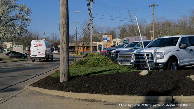
A view of an automobile dealership that has softened their business frontage. Something will have to give way for the proposed 12′ asphalt bike road.
The study does not contain any data on the potential number of users, nor potential customers to Loveland Madeira Road businesses. The study also does not address any repercussions on the residential neighborhood of Main Street or the Business/Residential neighborhood on West Loveland Avenue. For instance, it does not address future maintenance or whether property owners will be responsible for snow and ice removal on a path that replaces their current sidewalks. It’s right to ask when residents are left without sidewalks, “When will the bike road be cleared of snow? Who will do it, with what type of equipment, and when will it happen?”
A close look at what is described as a “Detailed Cost Estimate” appears to be grossly underestimated in terms of things that are absent consideration such as acquiring private property, relocating business signs, and replacing private parking,
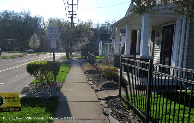
Light colored 4′ tree-shaded concrete sidewalks where children can walk without shoes, and people walk their dogs will be replaced with a 12’ barren swath of black, heat-absorbing asphalt the width of a one-lane road just feet from homes.
Light colored 4′ tree-shaded concrete sidewalks where children can walk without shoes, and people walk their dogs will be replaced with a 12’ barren swath of black, heat-absorbing asphalt the width of a one-lane road just feet from homes where owners will pay higher air-conditioning costs.
There has been no recommendation to forward the proposal to the Planning and Zoning Commission, Tree and Environment Committee, Beautification Committee, or Safety Service & Street Improvement Committee for review. No public hearings are scheduled. None have been suggested.
Phelps and City Manager Dave Kennedy have attended workshop/training on a Federal grant program along with a meeting with OKI officials to discuss the city’s project in more detail. While the updated cost estimate is being secured, the grant application is being reviewed and various needed documents are prepared. They plan to ask City Council in May to move forward seeking funding.
Phelps said that people who are using the bike trail are using too many of the downtown parking spots and using them for too long a period of time. “This is going to give them another place to get on the trail, better parking, easier on and off.” He believes the bike road will bring in new customers to Loveland Madeira Road businesses when they park nearby but head into Historic Downtown. The study does not contain any data on the potential number of users, nor potential customers to Loveland Madeira Road businesses. The study also does not address any potential negative repercussions on the residential neighborhood of Main Street or the Business/Residential neighborhood on West Loveland Avenue.
Some “Progressives” may love the idea, some may like it but believe it ill-considered given the impact on individuals who live or have invested in the impacted area. Some money conservatives may believe it an economic boon to both the Historic District and Loveland Madeira Road. Some money crunchers may ask, where is the cost-benefit analysis and just how many people will actually use it and spend money along Loveland Madeira Road. Some may ask if all costs factors have been included in the early estimate and if the price tag goes north after a grant is awarded – who will get stuck.
Elliott said his email to City Hall, that included the City Manager, Mayor and Council, the Planning and Zoning Commission, the Recreation Commission, and the Streets and Public Safety Committee was his attempt to open a dialogue between the decision makers, and those “of us” who will be financially and personally affected.
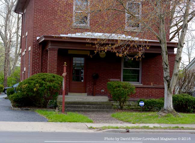
Resident and business owner Paul Elliott bought this business building on West Loveland Avenue in 1997. He has asked City Hall how the proposed connector path will affect the front yard of his property.
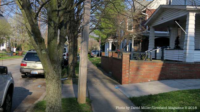
This is a view of business and residential properties on the South side of West Loveland Avenue. Although the proposal isn’t clear, presumably this 4′ concrete sidewalk will be replaced by a 12′ wide swath of asphalt, equivalent to a one-lane road. These street trees will with be cut down or have their roots severely damaged by the excavation. It is not clear whether the grassy strip will remain.
Another view of the beauty salon on the North side of West Loveland Avenue where construction of a 12′ wide swath of asphalt would require the removal of the front porch of this business. The entry to the basement of this business is through the porch floor.
If the 12′ wide bike road wraps around this building this sign and landscaping will have to go. The sign may need to be replaced with two signs to satisfy the business owner, yet there is no apparent budget item for moving or replacing business signs in the proposal.
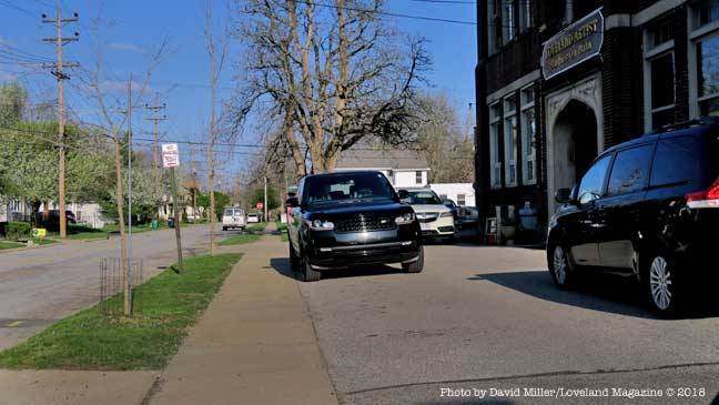
Depending whether the 12′ bike road goes down this side of Main Street, these street trees may be removed. These utility poles if moved to the left would might result in fatal topping of the trees. If the poles remain in place it puts the asphalt even closer to the house. If the road goes on top of the tree roots the trees will shortly die. The owners will pay higher air-conditioning cost without their shade trees. If the trees die because of the location of the bike road, the home owner will then be required to pay to have the tree removed. Will the homeowner’s brick wall survive the project?
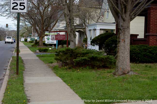
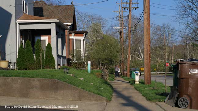
This is another problem area on Main Street where homeowners will lose a good portion of their already small front yard.
The 12′ bike road could cut across the front yard of this Main Street home taking out a tree and landscaping.
Another front porch, this one on Main Street may stand in the way of the 12′ wide asphalt bike road or end up only inches away.
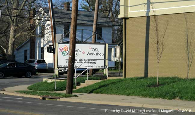
If the 12′ wide asphalt bike road goes down this side of Main Street it will leave the Artists Studios on Main without street trees and much needed parking.
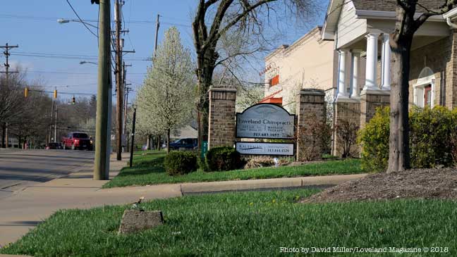
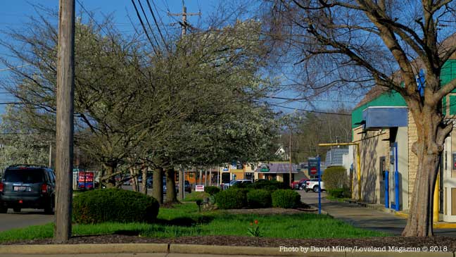
The landscaping, street trees, utility polls, and sign at this business on Loveland Madeira Road appear to be in the path of the 12′ wide bike road.
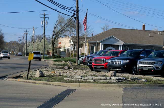
This landscaping area that softens the appearance of this automobile dealership on Loveland Madeira Road will be replaced with a 12″ asphalt bike road.
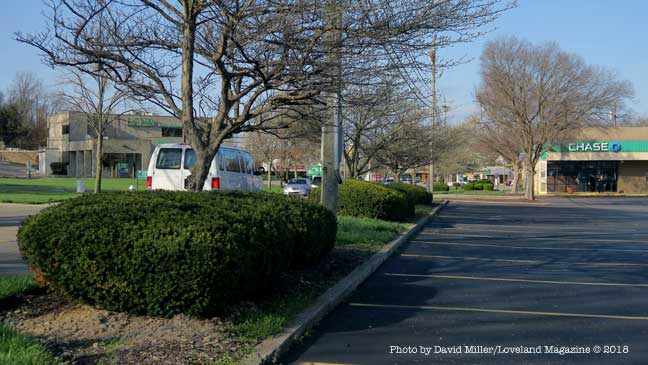
This is more of the landscaping along Loveland Madeira Road that will be removed (or most of the parking lot) to make room for a 12′ asphalt bike road.
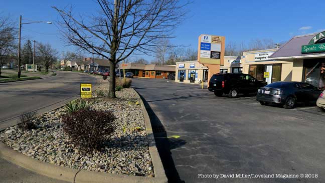
This is the only green space at the Chase Bank on Loveland Madeira Road. There will be a 12′ asphalt bike road running down the middle of it.
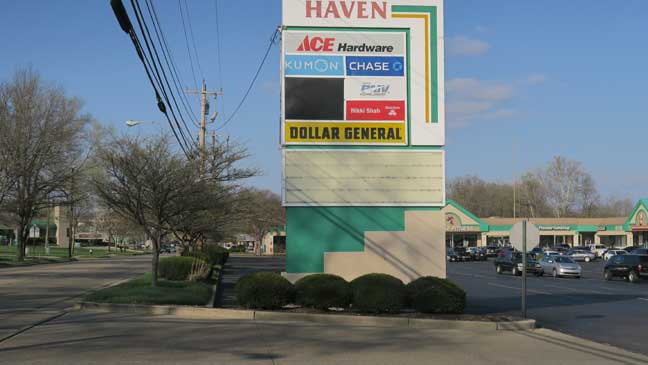
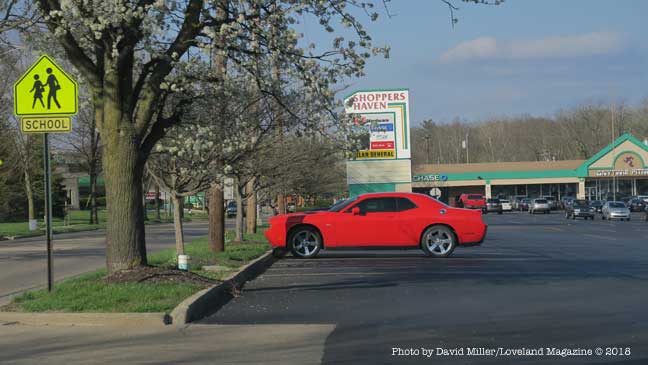
If a proposed 12′ wide asphalt bike road goes past Shoppers Haven shopping center these street trees may be removed, utility lines moved, parking spaces removed, or all three. Private property may have to be acquired through “willing seller – willing buyer” agreements or “taking” by eminent domain and associated legal costs. In the end, these parking spaces used by local businesses and the schools may be eliminated for the prospect of freeing up parking spaces a mile away in Historic Downtown.
There does not appear to be a budget item for moving this business sign out of the path of the proposed 12′ wide asphalt bike road, nor is there any discussion of whether the owner and the businesses would want their sign moved further away from the visibility of automobiles on Loveland Madeira Road.
If a proposed 12′ wide asphalt bike road goes past Shoppers Haven shopping center these street trees may be removed, utility lines moved, parking spaces removed, or all three. Private property may have to be acquired through “willing seller – willing buyer” agreements or “taking” by eminent domain and associated legal costs. In the end, these parking spaces used by local businesses and the schools may be eliminated for the prospect of freeing up parking spaces one mile away in Historic Downtown.
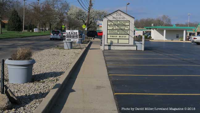
Will the landscaping and street buffer, the business sign and the parking at the 910 Building be sacrificed to free up an un-estimated number of parking spaces for the businesses one mile away in Historic Downtown?
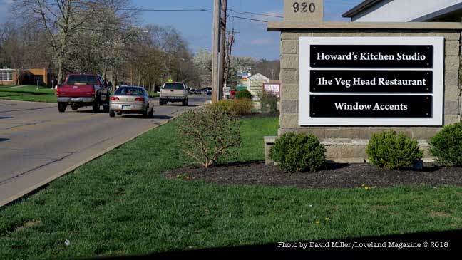
Another Loveland Madeira Road business sign in the way of a proposed 12′ asphalt bike road. Is this sign still going to have the same visibility if it is relocated? Is there enough room to just push it closer to the building or will it need to be re-engineered, and reconstructed smaller?
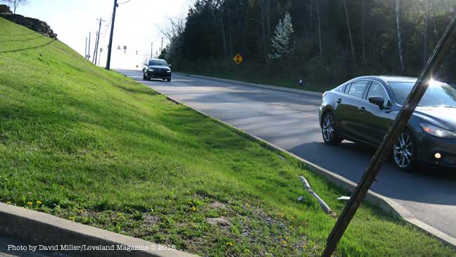
This is the hillside in front of New Hope Baptist Church where City Hall wants to build a 12′ wide asphalt bike road. Its there money in the estimate of cost to build a retaining wall or will the hill just get steeper?
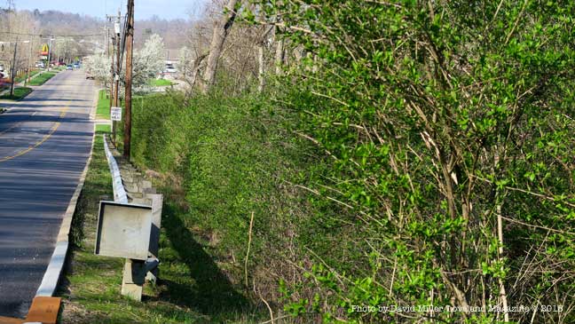
This is Loveland Madeira Road looking North from New Hope Baptist Church toward Kroger. The guard rail protects motorists from a steep immediate drop into a very deep ravine. The 350′ long stretch quickly drops 50′ below the grade of the road. It is not clear if the budget estimate has taken into consideration the expense of building a 12′ wide bike road at the edge of this ravine.


 You can help protect those most vulnerable


 by David Miller, Publisher