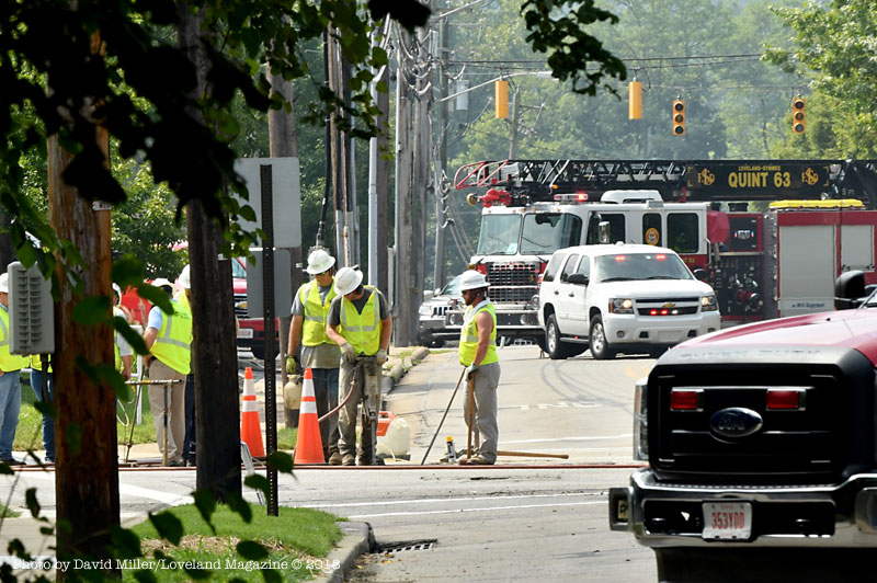
Loveland, Ohio – A natural gas leak at the intersection of West Loveland Avenue and Loveland Madeira Road that caused residents and business owners to evacuate around 10 AM this morning has been repaired.
A member of the Loveland/Symmes Fire Department and a Duke employee were checking for the presence of natural gas in the sewer lines this morning.
The intersection was opened for traffic at 8:20 PM.
Some residents were told to “shelter in place” and some were not allowed to enter their homes and businesses. Gas was detected inside some structures and Duke was monitoring sanitary and storm sewers, and basements for gas. One firefighter said that when they arrived at the scene this morning and lifted a manhole cover he could tell it was quite an extensive amount of gas. Gas was detected in some basements.
Crews spent the better part of the morning and afternoon trying to pinpoint the exact spot of the leak. When it was found, a sleeve was placed around the pipe and welded closed. A compression fitting connecting the 2″ gas line failed. A Duke supervisor said it was a small leak, however because of the subsurface in the area being sand and gravel in this river valley, the gas traveled quite far from the leak before it was smelled on the surface.
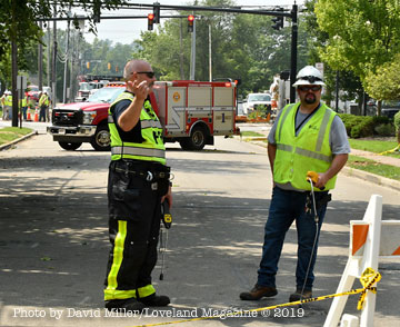
Loveland, Ohio – Duke crews told Loveland Magazine at noon that they have not yet located the exact location of a natural gas leak that caused residents and business owners to evacuate around 10 AM this morning.
At this time some are still being told to “shelter in place” and some are still not allowed back inside structures. Gas was detected inside some structures and Duke is currently monitoring sanitary and storm sewers, and basements for gas.
Crews are currently digging and using jackhammers at the West Loveland Avenue and Loveland Madeira Road intersection.
West Loveland Avenue is closed at Wall Street and further west up the hill past the Loveland Dairy Mart.
Loveland Madeira Road is closed at Main and at Elm.
Loveland, Ohio – At 7:26 PM Tuesday, Loveland Madeira Road was without the hint of what it turned into by 7:34 PM. It was not the proverbial “torrential downpour” where windshield wipers couldn’t keep up or visibility poor, but in only eight minutes the roadway and a local parking lot were like you see in these photos. The flooding was fed by rain coming down Valley View Lane and from the hillside above the Loveland Shopping Center.
The Loveland Police Department arrived within those eight minutes and prevented more vehicles from navigating the rapidly rising water.
This is the second time in recent months the infrastructure in the area was unable to handle a moderate storm. It did not appear the water entered any of the numerous businesses in the area.
RP DIAMOND IS THE EXCLUSIVE RETAILER OF LOVELAND HIGH SCHOOL SPIRIT WEAR
Welcome to RP Diamond Printing & Embroidery located at 370 Loveland Madeira Road
We specialize in spirit wear for schools, sports, clubs and organizations of any size, as well as community events. From screen printing to embroidery, promotional items to names and numbers for your uniforms, we can take care of your needs.
We invite you to browse through our store in the Loveland Shopping Center at 370 Loveland Madeira Road and shop with confidence. We invite you to create an account with us if you like, or shop as a guest. Either way, your shopping cart will be active until you leave the store.
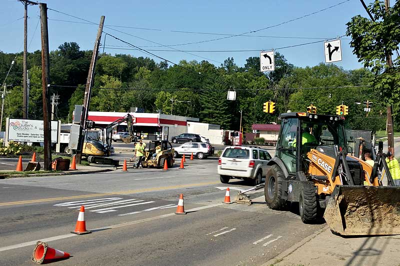
Loveland, Ohio – The City of Loveland has budgeted $205,000 for construction improvements to the traffic signal at West Loveland Avenue, Loveland-Madeira Road, and Elm Street. The intersection will receive replacements of the controller, wiring, and other features, as well as an upgrade to radar vehicular detection capability and decorative poles. The City hired TEC Engineering began the traffic study and timing plan in 2017 in anticipation of this project.
The project has been awarded to Elex, Inc., with construction planned to begin in late July and be complete by December 2018.
Duke is also planning a gas service upgrade within the intersection.
City Manager Dave Kennedy said, “The City’s project should be complete in 45 days. The traffic interruption portion of the project should be complete this week, weather dependent.”
Two Podcasts by Loveland Author and Counselor, Fran Hendrick, PCC
Back-to-School topic is empowering girls to develop new friendships. I’ll be showing you things you can do to help your daughter gain confidence as she starts school.
Starting school can be hard on kids — and moms, too. This post is for you if your child is struggling with separation anxiety. Make sure to download the free planning tool!
Next Saturday, July 21st, the Loveland Police Department is sponsoring “Stuff-A-Cruiser” food drive for the L.I.F.E. (Loveland InterFaith Effort) Food Pantry.They will be stationed at the Kroger on Loveland-Madeira Road and will be accepting food donations from 9 AM – 1 PM.Shoppers are encouraged to buy a few extra non-perishable food items, personal care products, or household cleaners – and then help Stuff-a-Cruiser!
Please mark your calendar and plan on some Saturday morning shopping to help benefit those from our community in need of assistance.
Loveland, Ohio – The annual Independence Day parade will depart the campus of the Loveland Primary/Elementary schools at 7 PM heading up Loveland Madeira Road to the West Loveland Historic District, crossing over the State and National Scenic Little Miami River, and ending in Historic Downtown.
There will be a festival in the Historic District starting at 4 PM.
Fireworks will be launched over the river beginning at 10 PM
EDITOR’S NOTE: In reaction to this editorial, City Council voted on Tuesday, April 24 to have a public hearing on this proposal during the City Council meeting of May 9.
It’s past time City Hall start a dialogue with those most affected
by David Miller, Publisher
Come take a walk with me while I tell you a story
It’s just my opinion, but I believe City Hall should start talking to people about this before it gets so far along people will need 1.6 million dollars worth of arguments against it. Once City Hall gets the funding for what they will describe as “Free Money” it will be extremely hard to turn council members to “No” votes. Residents should be given a fighting chance.
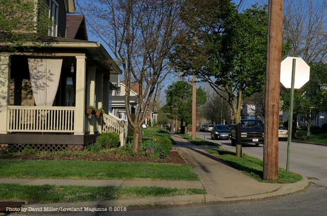
As the equivalent of a one-lane asphalt road that will cozy within feet of the front doors of homes and businesses in the West Loveland Historic District and along Loveland Madeira Road, and City Hall moves closer to securing funding, property, and homeowners have yet been asked their opinion. Almost all do not yet know the proposal has already been partially funded by Hamilton County and the Ohio, Kentucky, Indiana Council of Governments has committed their resources to finding 80 percent of the $1,623,000 and growing price tag for construction.
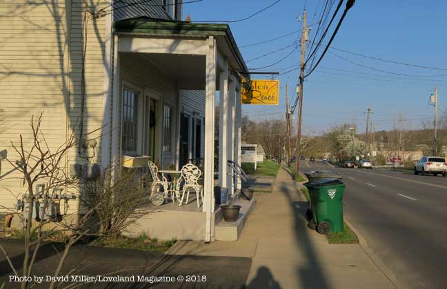
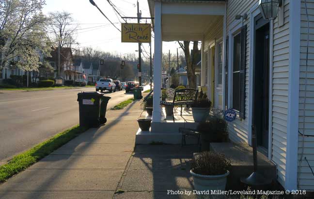
This is a view of the North side of West Loveland Avenue where construction of a 12′ wide swath of asphalt would require the removal of the front porch of this business. The entry to the basement of this business is through the porch floor.
Some front porches would have to be removed to accommodate the 12’ wide asphalt bicycle road. The road will be reduced to 10’ wide only where construction proves difficult.
As the City Hall proposal gets yet more expensive and closer to fruition there is still no initiative from the Council table to ask the thoughts and suggestions of citizens, home-owners, affected businesses, property owners, or pertinent City Commissions and Committees.
As the City Hall proposal gets yet more expensive and closer to fruition there is still no initiative from the Council table to ask the thoughts and suggestions of citizens, home-owners, affected businesses, property owners, or pertinent City Commissions and Committees.
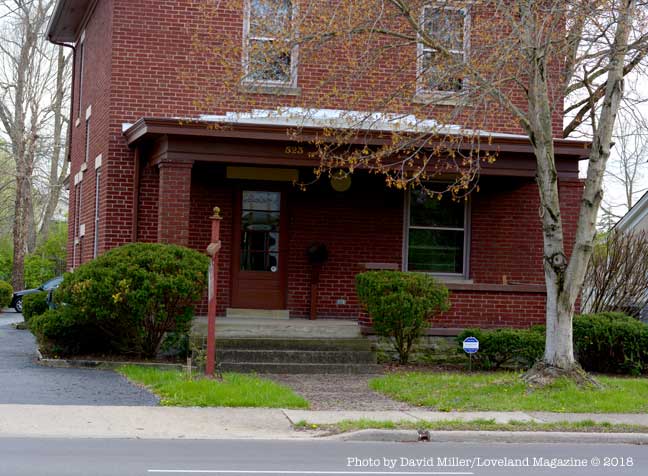
One property and business owner along the proposed route wrote to City Hall. Paul Elliott said, “I am under the impression that such a proposal ‘has legs’, and city officials are even seeking funding sources. First, as a taxpaying resident and longtime business/property owner on West Loveland Avenue, I am disappointed that no city official has approached either the public in general nor us property owners who may be affected by such a bike corridor.”
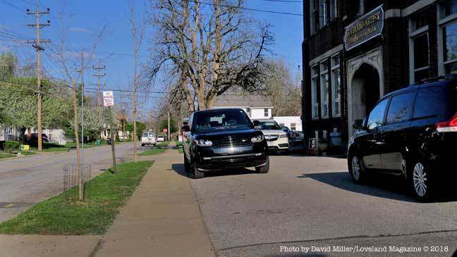
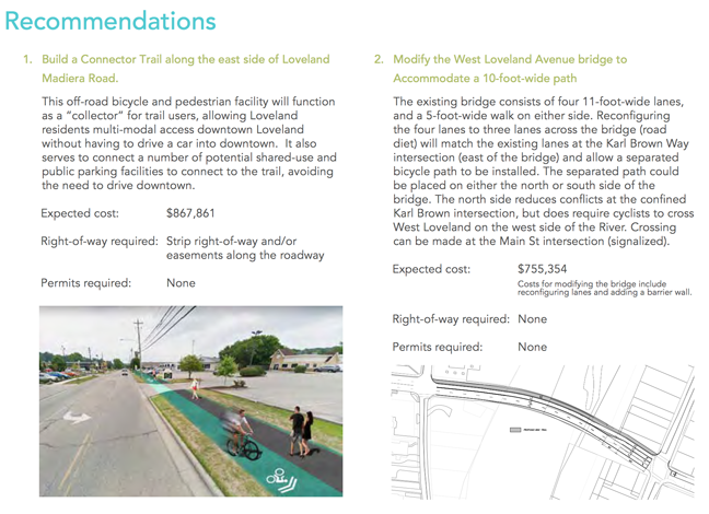
The project, called the Loveland Connector Trail, will be approximately 1.4 miles long and will begin at the Deer Ridge II Apartments being built next to New Hope Baptist Church. It will continue along Loveland Madeira Road to Main Street, to the southern part of Wall Street, then to West Loveland Avenue, crossing over the Little Miami River at the Col. Paxton Bridge ending in Historic Downtown.
“I am disappointed that no city official has approached either the public in general nor us property owners who may be affected by such a bike corridor.” – Resident and affected business owner, Paul Elliott.
The goal and impetus for the project are to reduce congested parking in the Downtown Historic District by encouraging Loveland Bike Trail users to park somewhere along the new bike road and ride their bikes into Historic Downtown.
City Manager, Dave Kennedy announced in February that he was confident he will find 80% of the $1,623,000 cost from the Federal Government. He has since announced changes that will raise the price tag an undetermined amount.
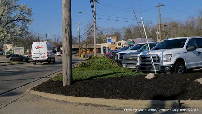
A view of an automobile dealership that has softened their business frontage. Something will have to give way for the proposed 12′ asphalt bike road.
The study does not contain any data on the potential number of users, nor potential customers to Loveland Madeira Road businesses. The study also does not address any repercussions on the residential neighborhood of Main Street or the Business/Residential neighborhood on West Loveland Avenue. For instance, it does not address future maintenance or whether property owners will be responsible for snow and ice removal on a path that replaces their current sidewalks. It’s right to ask when residents are left without sidewalks, “When will the bike road be cleared of snow? Who will do it, with what type of equipment, and when will it happen?”
A close look at what is described as a “Detailed Cost Estimate” appears to be grossly underestimated in terms of things that are absent consideration such as acquiring private property, relocating business signs, and replacing private parking,
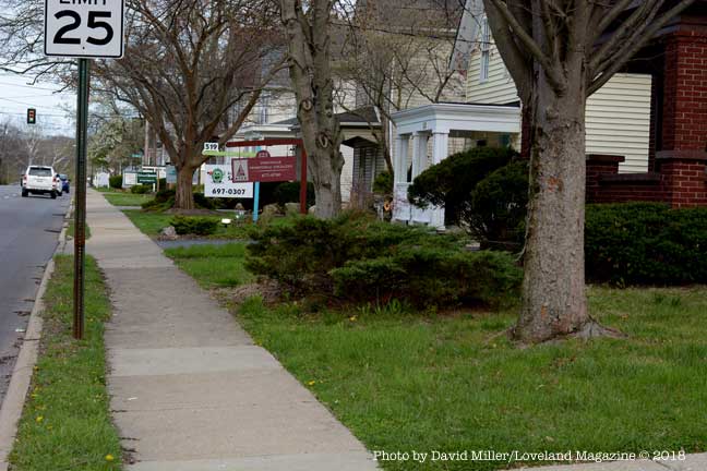
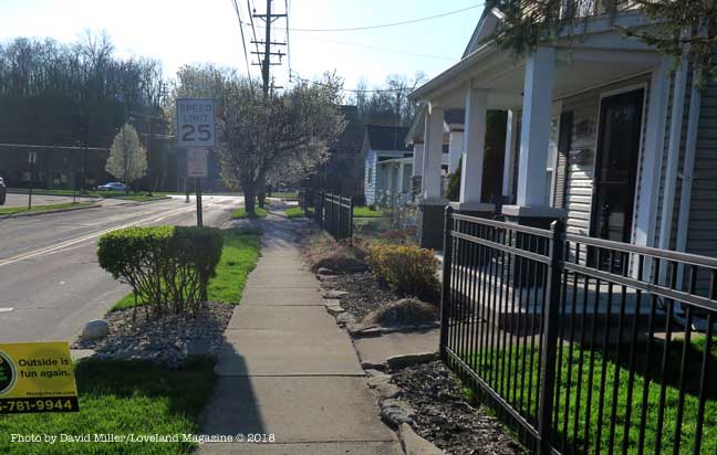
Light colored 4′ tree-shaded concrete sidewalks where children can walk without shoes, and people walk their dogs will be replaced with a 12’ barren swath of black, heat-absorbing asphalt the width of a one-lane road just feet from homes.
Light colored 4′ tree-shaded concrete sidewalks where children can walk without shoes, and people walk their dogs will be replaced with a 12’ barren swath of black, heat-absorbing asphalt the width of a one-lane road just feet from homes where owners will pay higher air-conditioning costs.
There has been no recommendation to forward the proposal to the Planning and Zoning Commission, Tree and Environment Committee, Beautification Committee, or Safety Service & Street Improvement Committee for review. No public hearings are scheduled. None have been suggested.
Phelps and City Manager Dave Kennedy have attended workshop/training on a Federal grant program along with a meeting with OKI officials to discuss the city’s project in more detail. While the updated cost estimate is being secured, the grant application is being reviewed and various needed documents are prepared. They plan to ask City Council in May to move forward seeking funding.
Phelps said that people who are using the bike trail are using too many of the downtown parking spots and using them for too long a period of time. “This is going to give them another place to get on the trail, better parking, easier on and off.” He believes the bike road will bring in new customers to Loveland Madeira Road businesses when they park nearby but head into Historic Downtown. The study does not contain any data on the potential number of users, nor potential customers to Loveland Madeira Road businesses. The study also does not address any potential negative repercussions on the residential neighborhood of Main Street or the Business/Residential neighborhood on West Loveland Avenue.
Some “Progressives” may love the idea, some may like it but believe it ill-considered given the impact on individuals who live or have invested in the impacted area. Some money conservatives may believe it an economic boon to both the Historic District and Loveland Madeira Road. Some money crunchers may ask, where is the cost-benefit analysis and just how many people will actually use it and spend money along Loveland Madeira Road. Some may ask if all costs factors have been included in the early estimate and if the price tag goes north after a grant is awarded – who will get stuck.
Elliott said his email to City Hall, that included the City Manager, Mayor and Council, the Planning and Zoning Commission, the Recreation Commission, and the Streets and Public Safety Committee was his attempt to open a dialogue between the decision makers, and those “of us” who will be financially and personally affected.
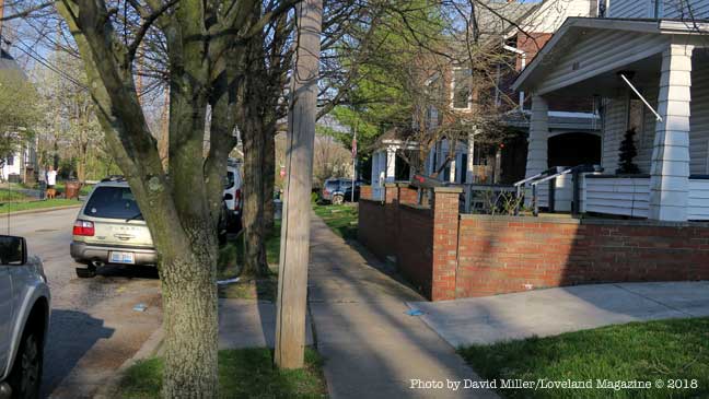
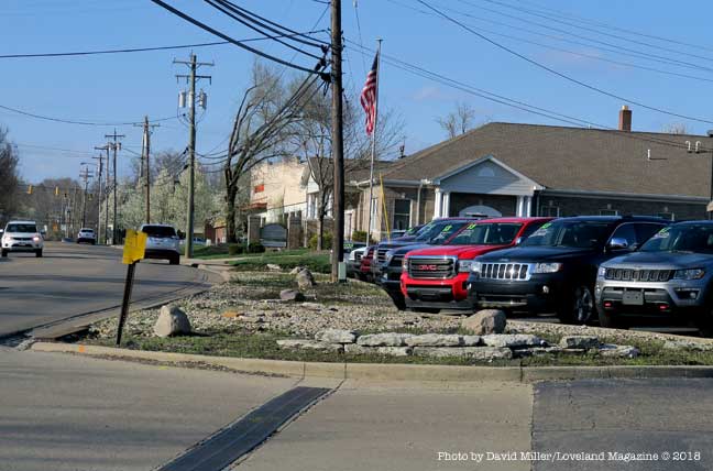
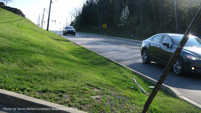
Resident and business owner Paul Elliott bought this business building on West Loveland Avenue in 1997. He has asked City Hall how the proposed connector path will affect the front yard of his property.This is a view of business and residential properties on the South side of West Loveland Avenue. Although the proposal isn’t clear, presumably this 4′ concrete sidewalk will be replaced by a 12′ wide swath of asphalt, equivalent to a one-lane road. These street trees will with be cut down or have their roots severely damaged by the excavation. It is not clear whether the grassy strip will remain.
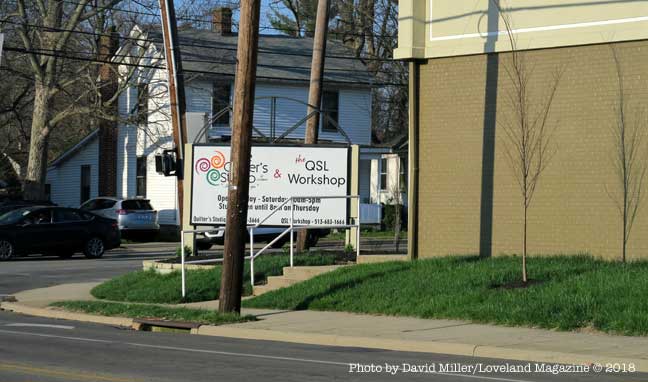
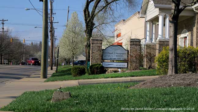
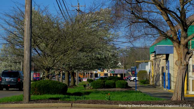
Another view of the beauty salon on the North side of West Loveland Avenue where construction of a 12′ wide swath of asphalt would require the removal of the front porch of this business. The entry to the basement of this business is through the porch floor.If the 12′ wide bike road wraps around this building this sign and landscaping will have to go. The sign may need to be replaced with two signs to satisfy the business owner, yet there is no apparent budget item for moving or replacing business signs in the proposal.Depending whether the 12′ bike road goes down this side of Main Street, these street trees may be removed. These utility poles if moved to the left would might result in fatal topping of the trees. If the poles remain in place it puts the asphalt even closer to the house. If the road goes on top of the tree roots the trees will shortly die. The owners will pay higher air-conditioning cost without their shade trees. If the trees die because of the location of the bike road, the home owner will then be required to pay to have the tree removed. Will the homeowner’s brick wall survive the project?This is another problem area on Main Street where homeowners will lose a good portion of their already small front yard.The 12′ bike road could cut across the front yard of this Main Street home taking out a tree and landscaping.Another front porch, this one on Main Street may stand in the way of the 12′ wide asphalt bike road or end up only inches away.If the 12′ wide asphalt bike road goes down this side of Main Street it will leave the Artists Studios on Main without street trees and much needed parking.The landscaping, street trees, utility polls, and sign at this business on Loveland Madeira Road appear to be in the path of the 12′ wide bike road.This landscaping area that softens the appearance of this automobile dealership on Loveland Madeira Road will be replaced with a 12″ asphalt bike road.This is more of the landscaping along Loveland Madeira Road that will be removed (or most of the parking lot) to make room for a 12′ asphalt bike road.
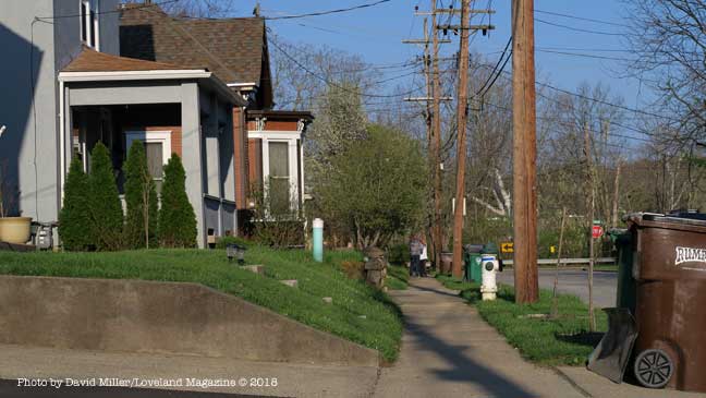
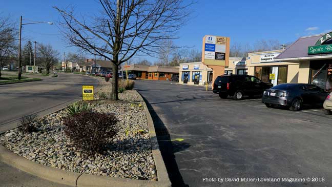
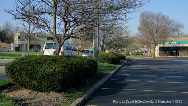
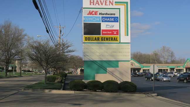
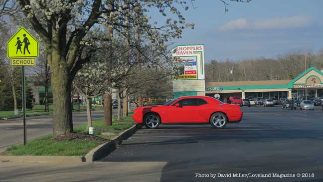
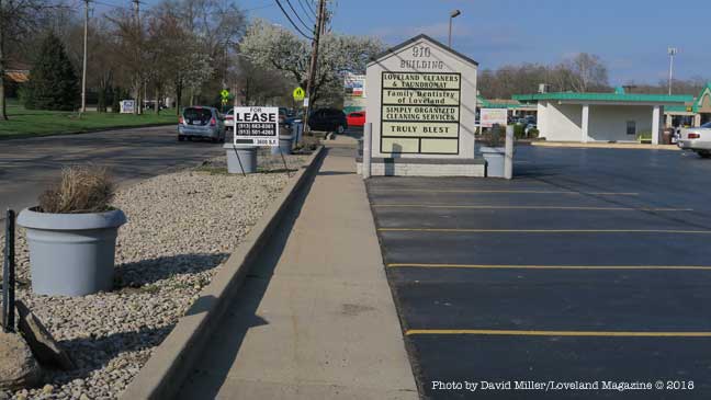
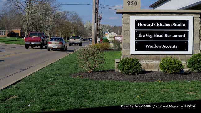
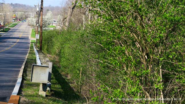
This is the only green space at the Chase Bank on Loveland Madeira Road. There will be a 12′ asphalt bike road running down the middle of it.If a proposed 12′ wide asphalt bike road goes past Shoppers Haven shopping center these street trees may be removed, utility lines moved, parking spaces removed, or all three. Private property may have to be acquired through “willing seller – willing buyer” agreements or “taking” by eminent domain and associated legal costs. In the end, these parking spaces used by local businesses and the schools may be eliminated for the prospect of freeing up parking spaces a mile away in Historic Downtown.There does not appear to be a budget item for moving this business sign out of the path of the proposed 12′ wide asphalt bike road, nor is there any discussion of whether the owner and the businesses would want their sign moved further away from the visibility of automobiles on Loveland Madeira Road.If a proposed 12′ wide asphalt bike road goes past Shoppers Haven shopping center these street trees may be removed, utility lines moved, parking spaces removed, or all three. Private property may have to be acquired through “willing seller – willing buyer” agreements or “taking” by eminent domain and associated legal costs. In the end, these parking spaces used by local businesses and the schools may be eliminated for the prospect of freeing up parking spaces one mile away in Historic Downtown.Will the landscaping and street buffer, the business sign and the parking at the 910 Building be sacrificed to free up an un-estimated number of parking spaces for the businesses one mile away in Historic Downtown?Another Loveland Madeira Road business sign in the way of a proposed 12′ asphalt bike road. Is this sign still going to have the same visibility if it is relocated? Is there enough room to just push it closer to the building or will it need to be re-engineered, and reconstructed smaller?This is the hillside in front of New Hope Baptist Church where City Hall wants to build a 12′ wide asphalt bike road. Its there money in the estimate of cost to build a retaining wall or will the hill just get steeper?This is Loveland Madeira Road looking North from New Hope Baptist Church toward Kroger. The guard rail protects motorists from a steep immediate drop into a very deep ravine. The 350′ long stretch quickly drops 50′ below the grade of the road. It is not clear if the budget estimate has taken into consideration the expense of building a 12′ wide bike road at the edge of this ravine.
EDITORS NOTE:Because the proposal goes into no detail or discussion of possible negative impact to private property, homeowners (the residential Main Street neighborhood), schools, the natural environment, street trees, or aesthetics, this is an important read for those affected property owners along the proposed route.
City recommendation is for parking on west side of town and walking or bicycling into Historic District on new pathway and crossing river using existing bridge – Cost to be $1,623,000.
by David Miller
Loveland, Ohio – The City commissioned a study of how to alleviate parking congestion yet bring more customers into Historic Downtown by developing a new crossing over the Little Miami River. The report was released last Wednesday. The recommendation is to create “parking pods” in existing commercial and school parking lots or create new parking lots on existing City owned land in the Loveland Madeira Road business corridor and in the West Loveland Historic District. A new ten-foot shared pathways for pedestrians and bicycles along Loveland Madeira, West Loveland Avenue, and possibly Main Street would bring the customers into the Historic District via the existing roadway of the Col. Thomas Paxton Bridge.
Talk of a new bridge over the State and National Little Miami Scenic River or expanding the existing bridge over the river have been abandoned in favor of using a shared lane for pedestrians and bicycles on the existing roadway over the bridge.
The report says:
While a stand-alone bridge, a modification to the existing bridge to create a cantilever type path were both examined, the most feasible and cost-effective crossing entails the modification of the existing lanes of traffic of the bridge to accommodate an expansion of the existing sidewalk.
The cost estimate for the project is $1,623,215.
Project Goals
• Develop a safe, feasible crossing over the Little Miami River • Reduce downtown traffic congestion by encouraging riders to park and ride into downtown
The preferred option according to a recommendation to City Council by City Manager Dave Kennedy is to modify the Col. Thomas Paxton Bridge to accommodate a 10 ft. wide separated path with three vehicle lanes across the bridge. The “collector pathway” is expected to encourage Loveland Bike Trail users to “park and walk or ride” into the Historic Downtown District.
Description
The Loveland Collector Trail will be a new, shared use, grade-separated facility connecting the Loveland Madeira Business Corridor to the Historic Downtown District. The intent of this facility is to provide visible, shared parking opportunities at strategic locations westof the river, along Loveland Madeira Rd, where Little Miami Scenic Trail users – or general visitors to Downtown Loveland – can park their vehicle and follow an easily-navigable shared-use trail along Loveland Madeira Rd, across the Little Miami Scenic River and into the Historic Downtown District to the Little Miami Scenic Trail trailhead.
Preferred Alignment
The eastern terminus of the proposed Loveland Connector Trail will begin at the proposed Deer Ridge II development (1401 Loveland Madeira Rd). The shared-use path will continue along Loveland Madeira Rd to W Loveland Rd, where users will turn right onto W Loveland Ave and cross the Little Miami Scenic River on the existing W Loveland Ave bridge into downtown Loveland.
Alternative Alignments
Similar to the preferred alignment, the shared-use path will continue along Loveland Madeira Rd to the south of Main Street where the City owns a vacant development parcel (referred to as the Chestnut St. Development) between Loveland Maderia Rd and the river. Users can turn right onto one of the three access points into the Chestnut St. development. From there they can either head north through the future development or the existing residential streets to access a river crossing.
“Next step is to seek funding for construction.” – City Manager Dave Kennedy
Kennedy is confident he will find 80% of the $1,623,000 cost from the Federal Government. The city was able to secure grant funding ($19,900) from the Hamilton County Planning and Development Department to conduct the feasibility study. At the council meeting, he said, “Next step is to seek funding for construction. We are still digesting it… looking for the funding.” He said councilman Ted Phelps is reaching out to the Ohio, Kentucky, Indiana Regional Council of Governments (OKI) for funding.
Also during the Council discussion, Phelps who is spearheading the project, inherited from former councilman Brent Zuck, said about the Loveland Connector Trail, “This serves two larger, important goals and it’s a big step towards getting those goals realized. Number one is to reduce traffic in downtown Loveland. Second thing it does… I think it’s an economic shot in the arm for the Loveland Madeira corridor which I think will have positive repercussions.”
Phelps said that people who are using the bike trail are using too many of the downtown parking spots and using them for too long a period of time. “This is going to give them another place to get on the trail, better parking, easier on and off.”
“In delivering it (the study) to Bob Koehler at last week at the regular OKI meeting, he was very positive in terms of its reception,” said Phelps. Koehler is Deputy Executive Director/Transportation Manager at OKI.
Phelps said, “We will be moving forward on this and I think it will be another great feather in the cap of Loveland when it’s realized.”
“We still need people to weigh in on it,” Phelps said. “We will be moving forward on this and I think it will be another great feather in the cap of Loveland when it’s realized.” He suggested the plan be put on the City’s website.
The study does not contain any data on potential number of users, nor potential customers to Loveland Madeira Road businesses. The study also does not address any repercussions on the residential neighborhood of Main Street or the Business/Residential neighborhood on West Loveland Avenue.
There has been no recommendation to forward the plan to the Planing and Zoning Commission, Tree and Environment Committee, Beautification Committee or Safety Service & Street Improvement Committee for review. No public hearings are scheduled.
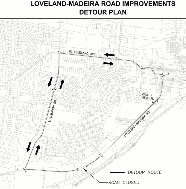
Loveland, Ohio – Construction has begun on the Loveland Madeira Road Storm Drainage project. The project includes a five day road closure of Loveland Madeira Road, scheduled to begin at 8 AM on Monday, October 9.
The closure will be in the 1400 block of Loveland Madeira Road. A detour plan has been established, routing traffic along West Loveland Avenue and South Lebanon Road to avoid the closure.
Access will be maintained from West Loveland Avenue to all businesses on Loveland Madeira Road up to and including Kroger, New Hope Baptist Church, and Highridge Drive.
Access will be maintained from I-275 to all businesses up to Johnny’s Car Wash on Loveland Madeira Road. Access will be maintained to Pet Nation Lodge and ABRA Auto Body, although the approach direction available will vary during the closure.
Hearts are broken today, we are all wishing we could make the world safe for our children. I know. What is within our power is to build our children’s resilience — that combination of a strong sense of self, a belief in their own capability, and a trusted network of support. It’s not rocket science — but it takes know-how. And you can learn how do it.


 Welcome to


 by David Miller, Publisher